Inflatable kayaks & canoe expedition on the Moisie river – Labrador/Quebec, Canada – part 1
-
- Inflatable kayaks and canoes on the Moisie River

-

- Inflatable kayaks and canoes on the Moisie River
-
- Inflatable kayaks and canoes on the Moisie River
Inflatable kayaks & canoe expedition on the Moisie river – Labrador/Quebec, Canada.
Laurent Nicolet, creator of River-Equipements, has just returned from an inflatable kayak and canoe expedition on the Moisie River – a wild and unspoiled river in Newfoundlands-Labrador and Quebec – He’s going to publish a report and a guidebook of this route over 400 km, rated the “best expedition river” in Eastern Canada.
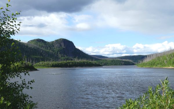
In this way, the river embodies the best definition of “Perfect Wilderness”, that’s why it could only attract our team of “Old River Rats” like a super-powerful magnet!
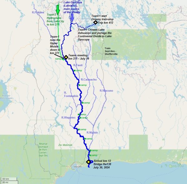
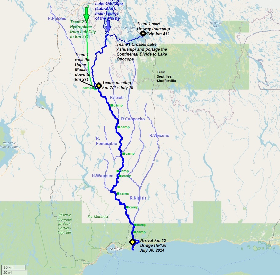
On the Moisie, the km are counted upwards: km 0 is the mouth into the Gulf of St. Lawrence, km 412 the very beginning of the route via the “head lakes” in Labrador.
* The map of the entire Moisie via “Lac Ashuanipi”, accessible via the “Sept-Iles – Shefferville” railway line: a total of 412 km route. We’ll start this episode at “km 271” shown on this map, only accessible by hydroplane, where Pierre and myself met up with the first team to complete the entire route.
-
- Inflatable kayaks and canoes on the Moisie River
-

- Inflatable kayaks and canoes on the Moisie River
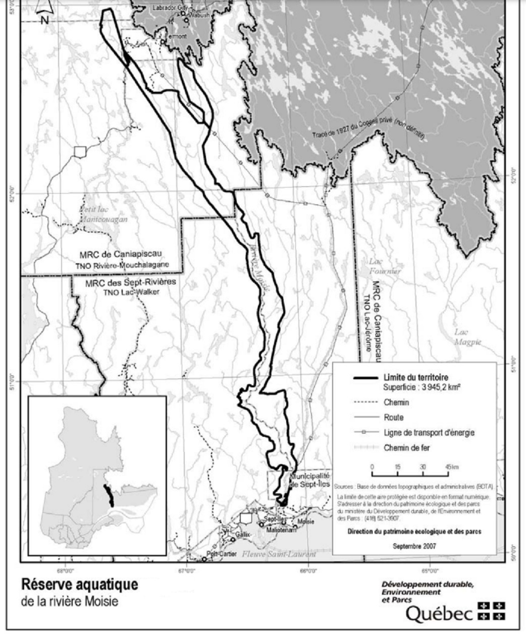
The river Moisie: from its source to 37 km from sea, the Moisie and its main tributaries Pekans and Carheil rivers, are entirely protected by a “Aquatic – Preservation” system , that covers also a river-corridor from 6 to 30 kilometer wide, totalizing 3898 km2. Inside this corridor, the rivers Moisie and tributaries are fully protected from all forms of industrial exploitation. The Reserve territory is protected from all forms of logging, mining and energy production. Activities likely to degrade the bed, the riverbed, banks or shoreline, or otherwise impair the integrity of the watercourse like such as the construction of dwellings or houses, the building of roads or paths, agriculture and livestock farming, are prohibited. (Source: Quebec Ministery of the Environment).
In this way, the river embodies the best definition of “Perfect Wilderness”, that’s why it could only attract our team of “Old River Rats” like a super-powerful magnet!
-
- Inflatable kayaks and canoes on the Moisie River

-
- Inflatable kayaks and canoes on the Moisie River

-
- Inflatable kayaks and canoes on the Moisie River
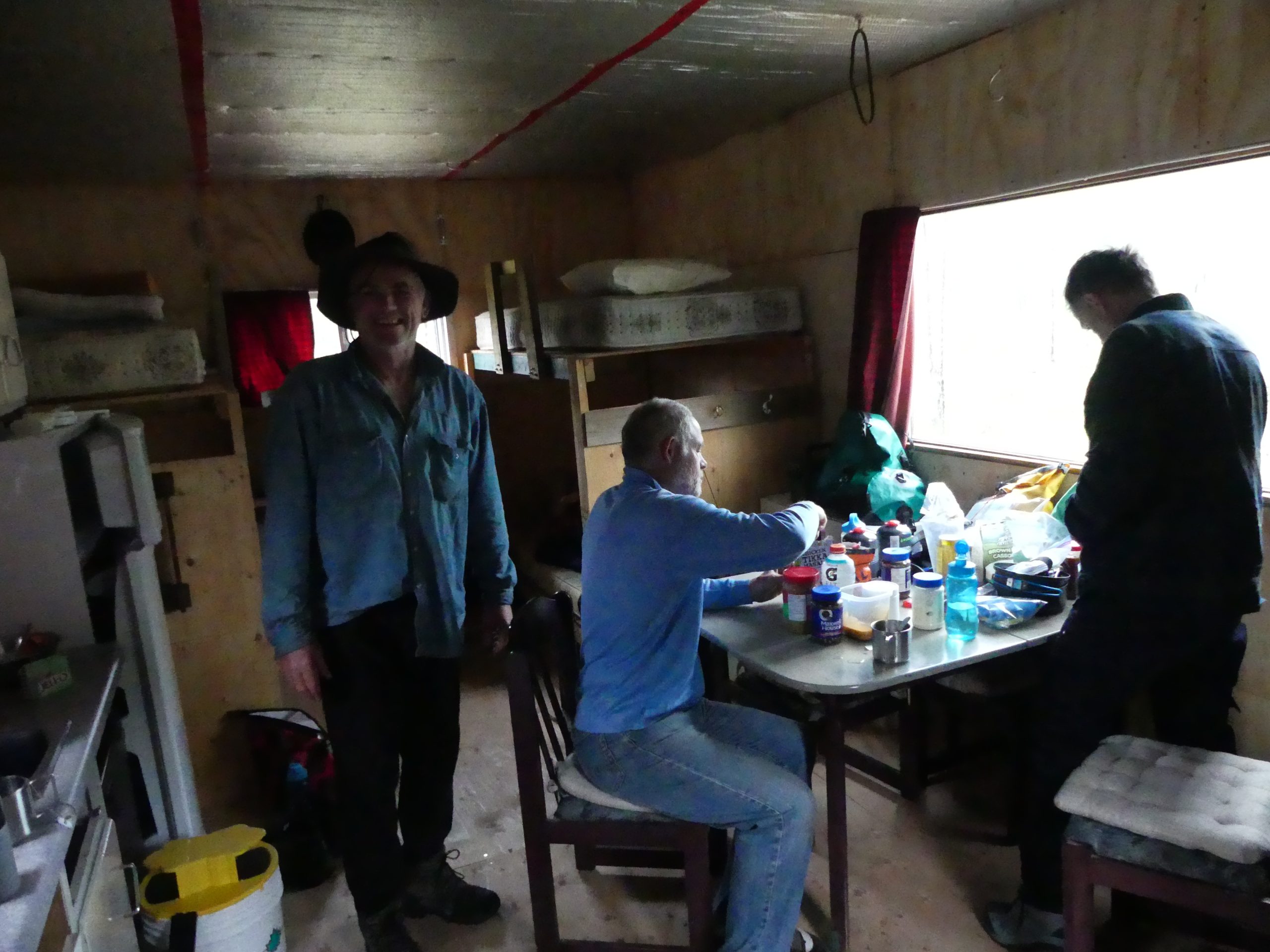
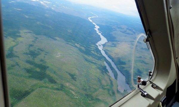
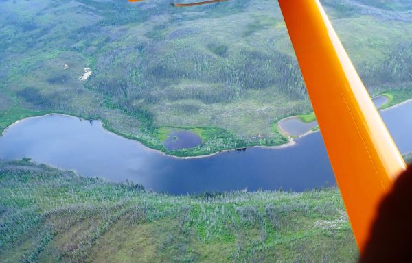
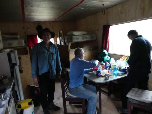
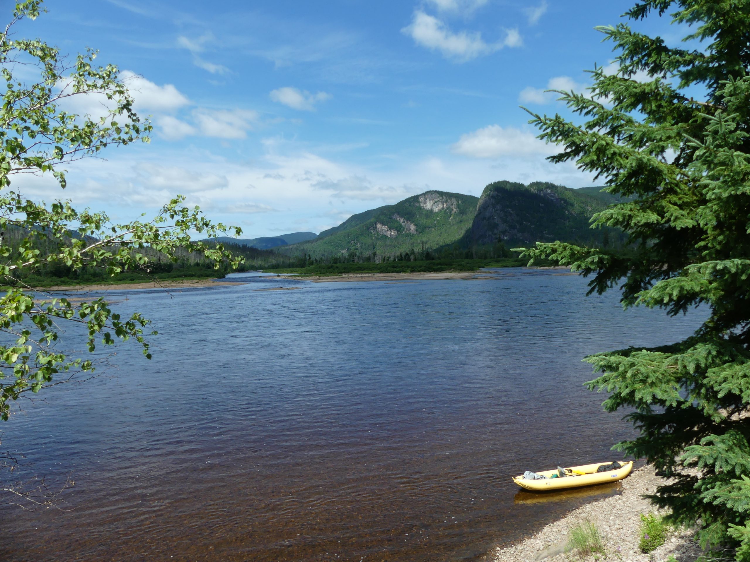
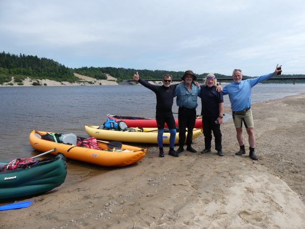
Leaving Labrador-City on July 18 evening, we fly first over the lakes, then over the Upper Moisie, and finally our landing place: an old trapping cabin lost in the middle of the immensity. The old cabin is the “Rendez-Vous” place with the rest of the team who will arrive with their inflatable canoes the next morning, having paddled 89 km on the head lakes, then 52 km of the falls-infested upper-Moisie, since 11 days. All 5 river-rats will then continue together down the main Moisie 271 remaining kilometers, for the next 13 days.
-

- Inflatable kayaks and canoes on the Moisie River
-
- Inflatable kayaks and canoes on the Moisie River

-

- Inflatable kayaks and canoes on the Moisie River
-
- Inflatable kayaks and canoes on the Moisie River

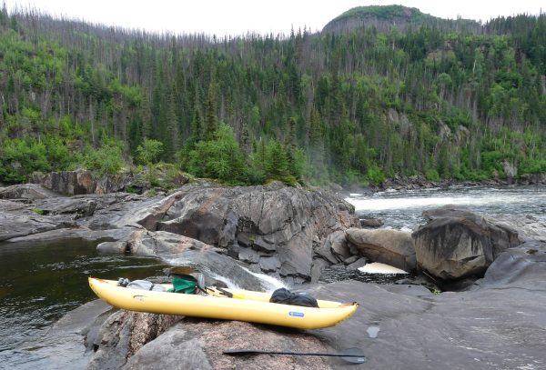
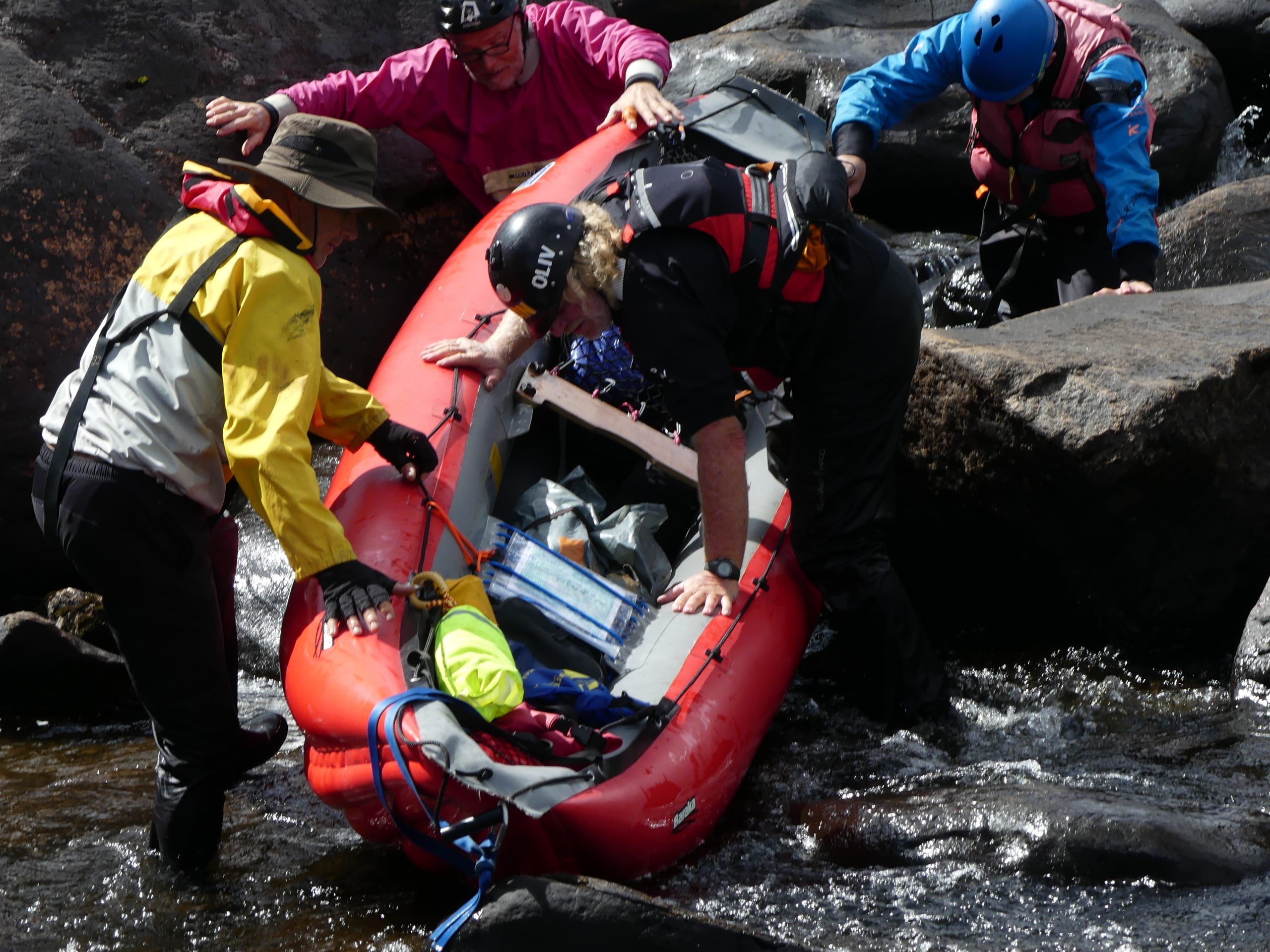
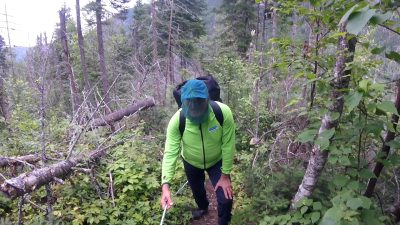
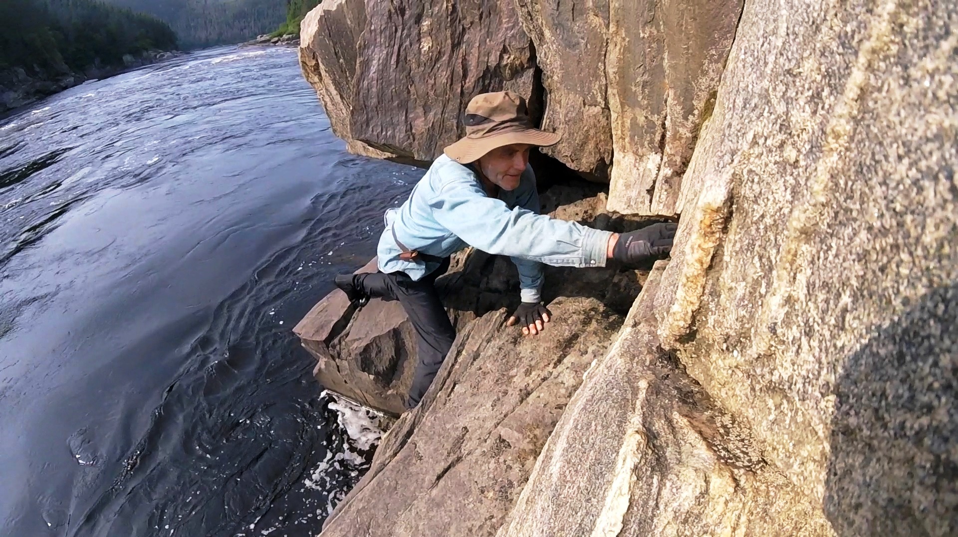
On 19th July waterfall awaited us 2 km downstream from the start, with an obligatory short 50 m portage that takes 20 min while we must hike down a narrow track zigzagging through the taiga and across large boulders: we have to hoist the boats onto the rocks and pass them on edge around the bends of a barely-marked path through the forest – impossible with loaded boats – we have to untie and remove our drybags and boxes, and come back for another trip or two, to carry them down the falls.
-

- Inflatable kayaks and canoes on the Moisie River

-
- Inflatable kayaks and canoes on the Moisie River
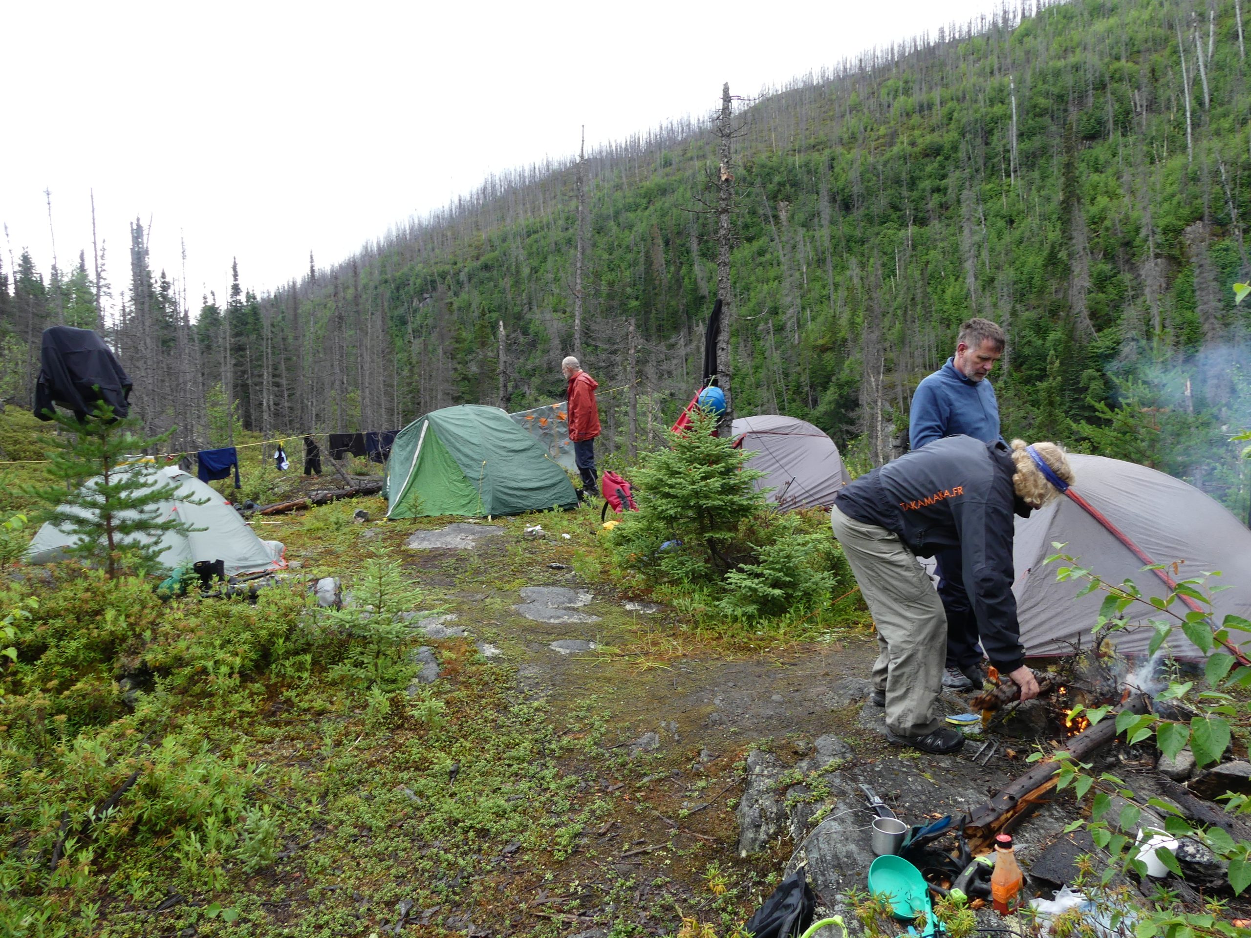
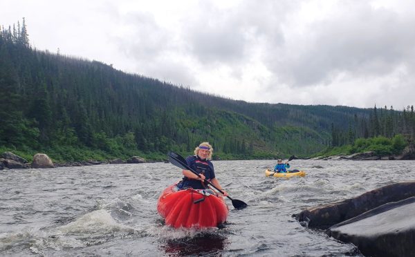
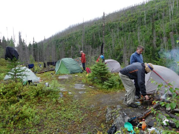
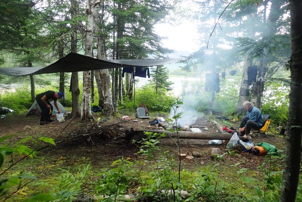
We continue downstream with small rapids and quieter sections to a first “camp site” marked “high up” on our maps. It took over twenty minutes to find it, so impenetrable was the bush!
-

- Inflatable kayaks and canoes on the Moisie River
-

- Inflatable kayaks and canoes on the Moisie River
-
- Inflatable kayaks and canoes on the Moisie River
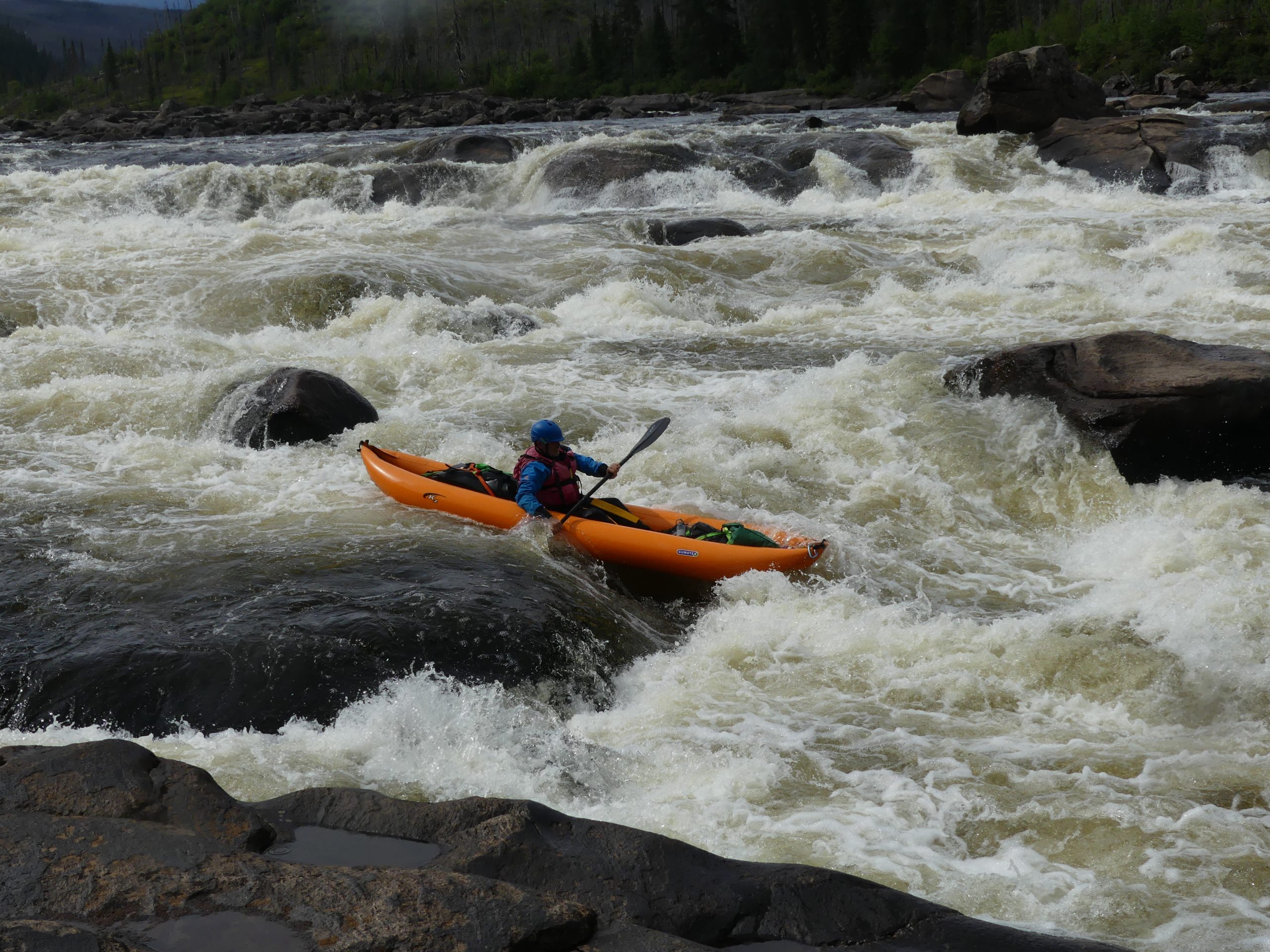
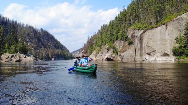
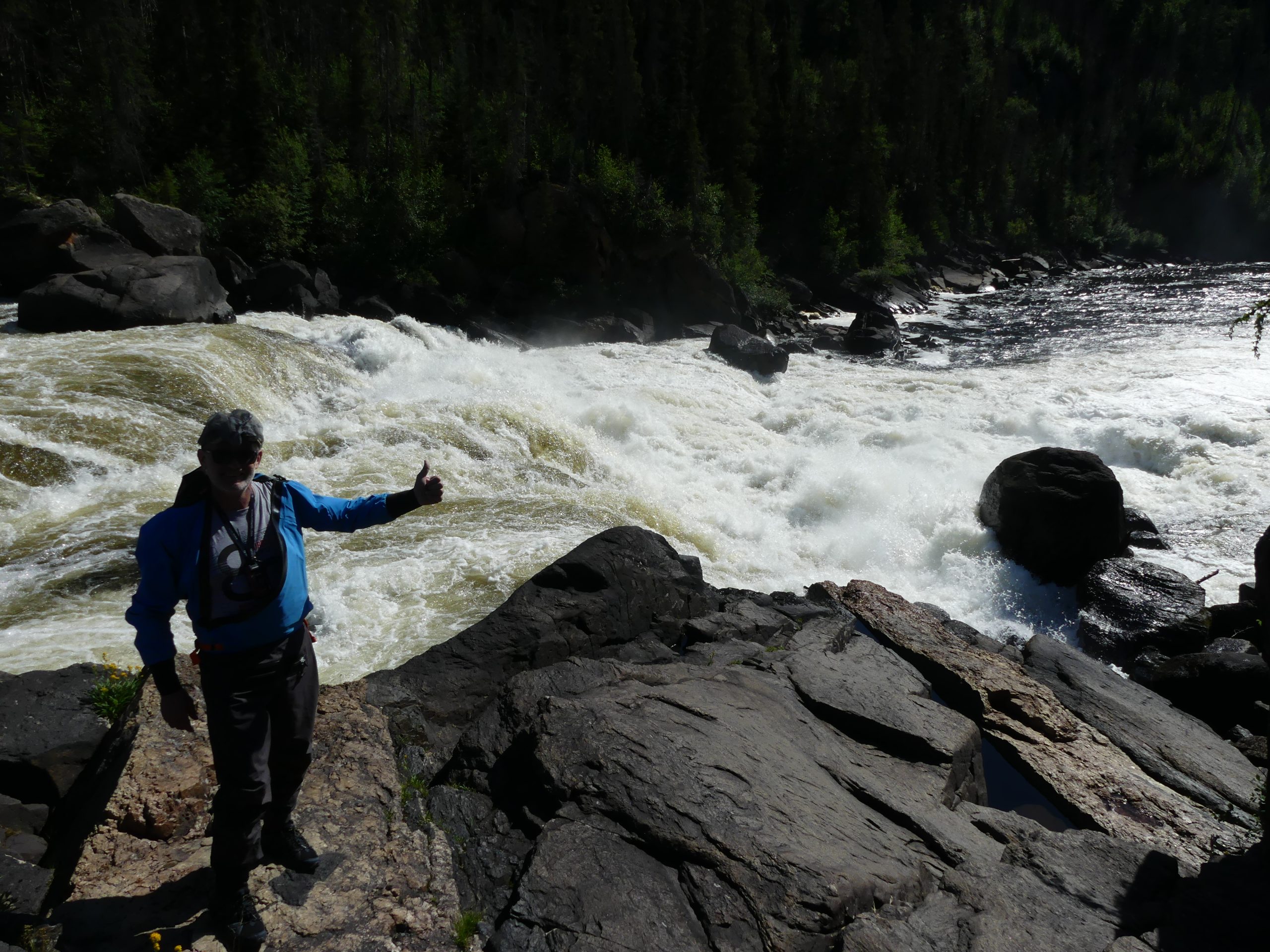
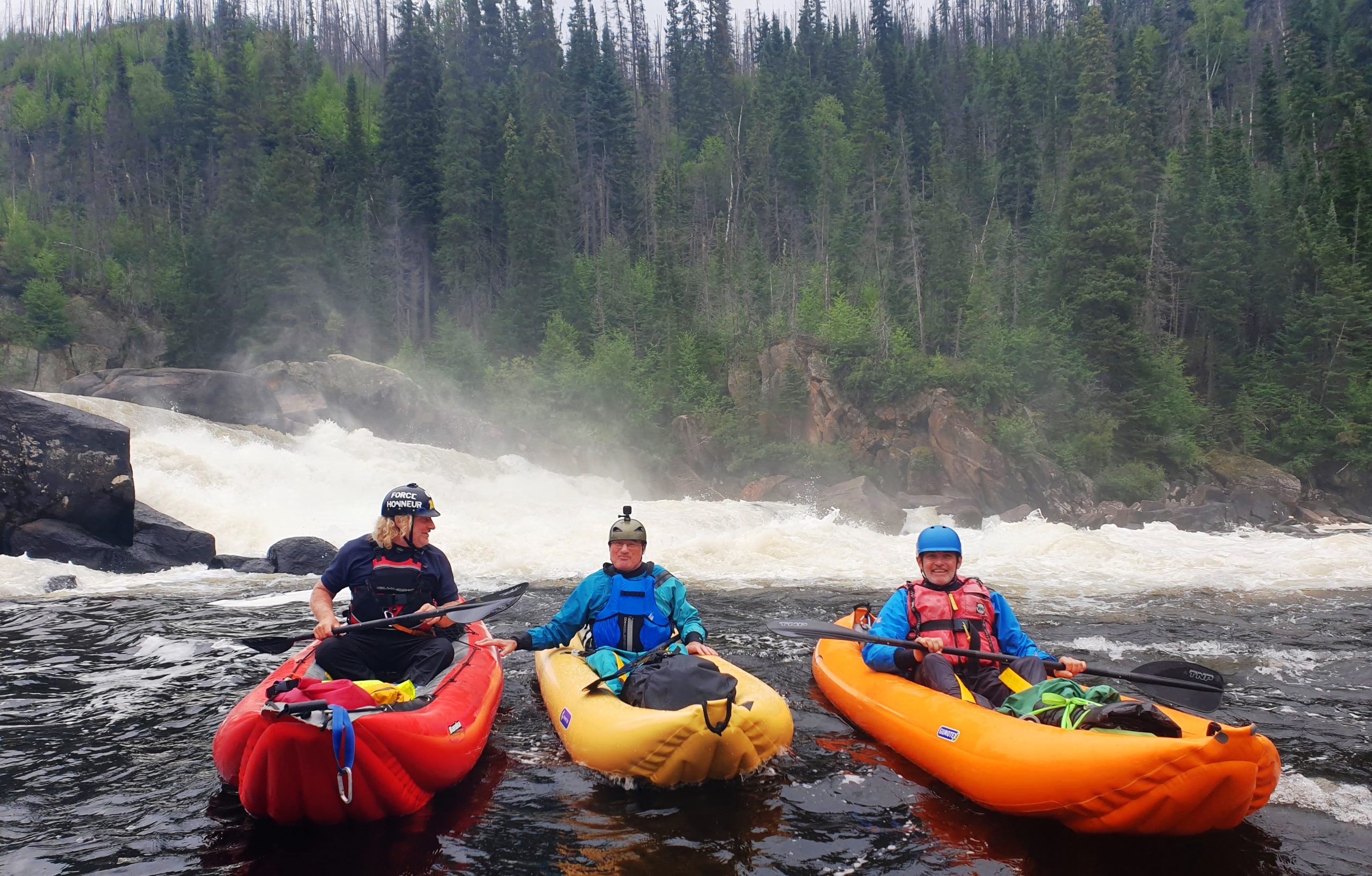
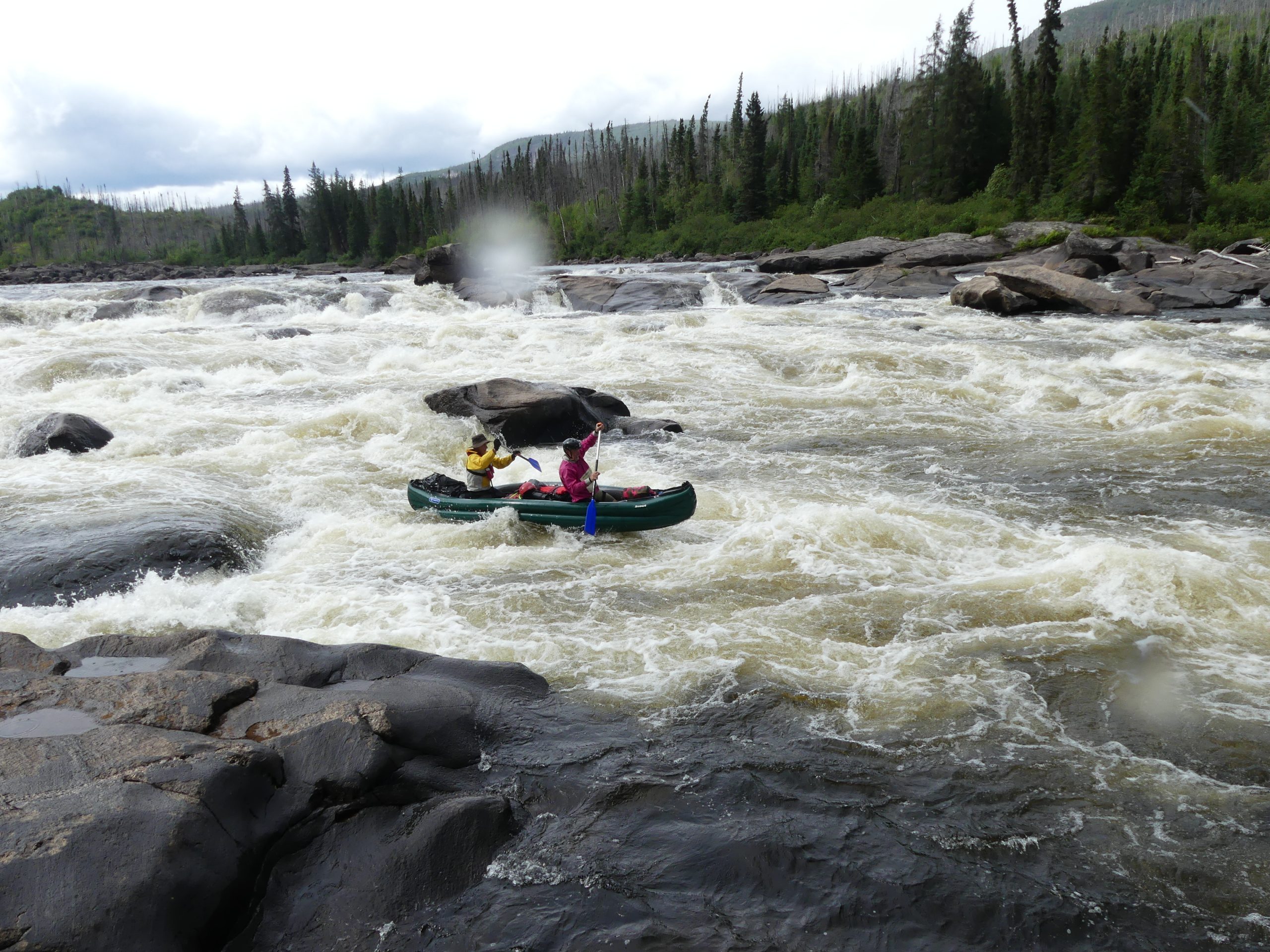
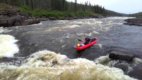
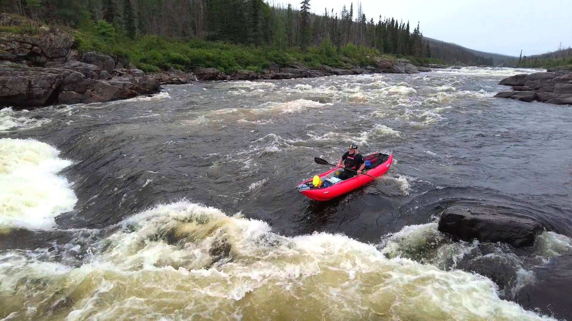
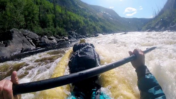
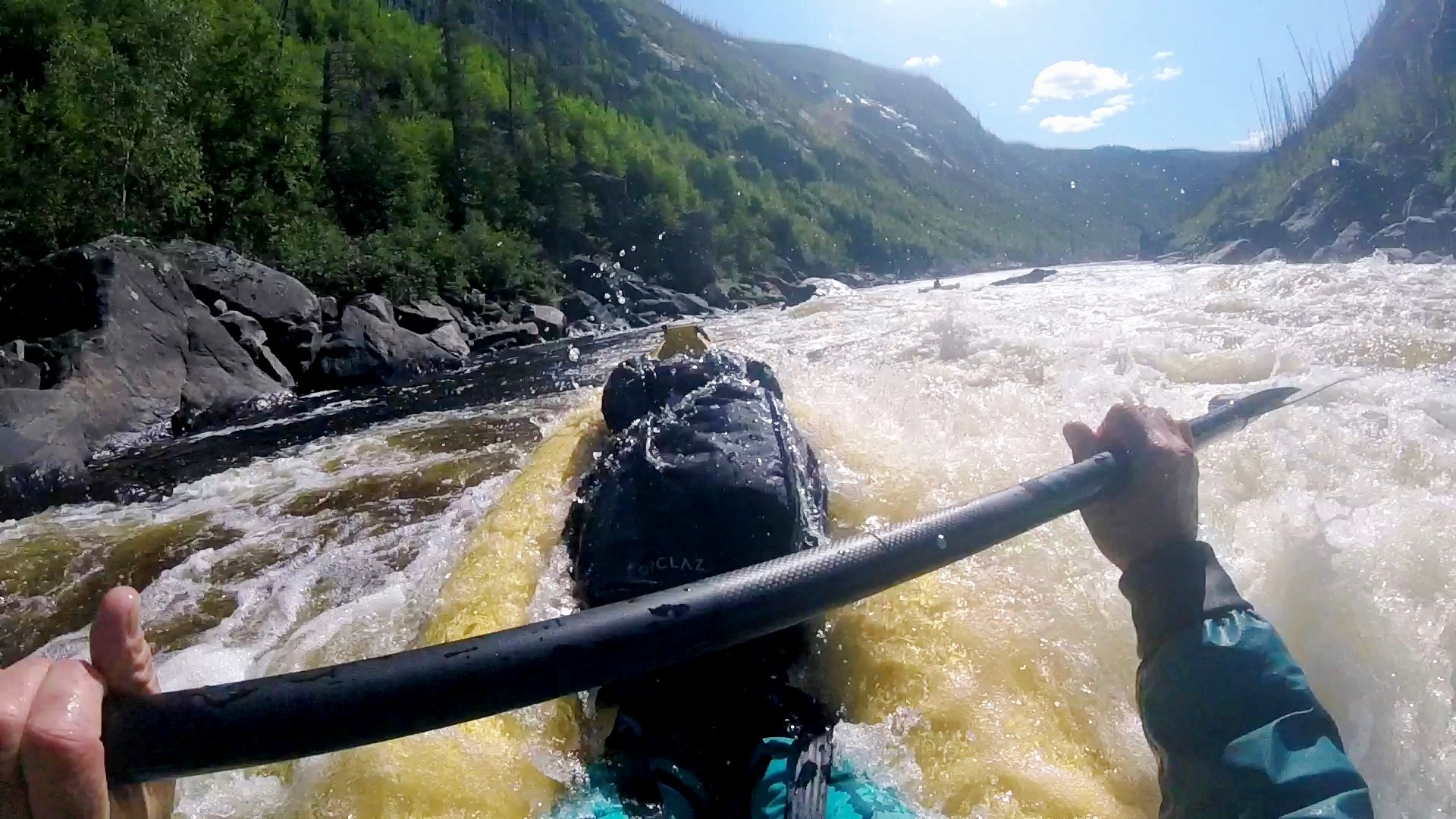
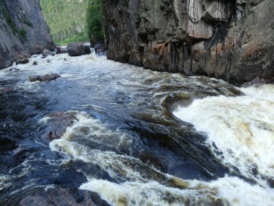
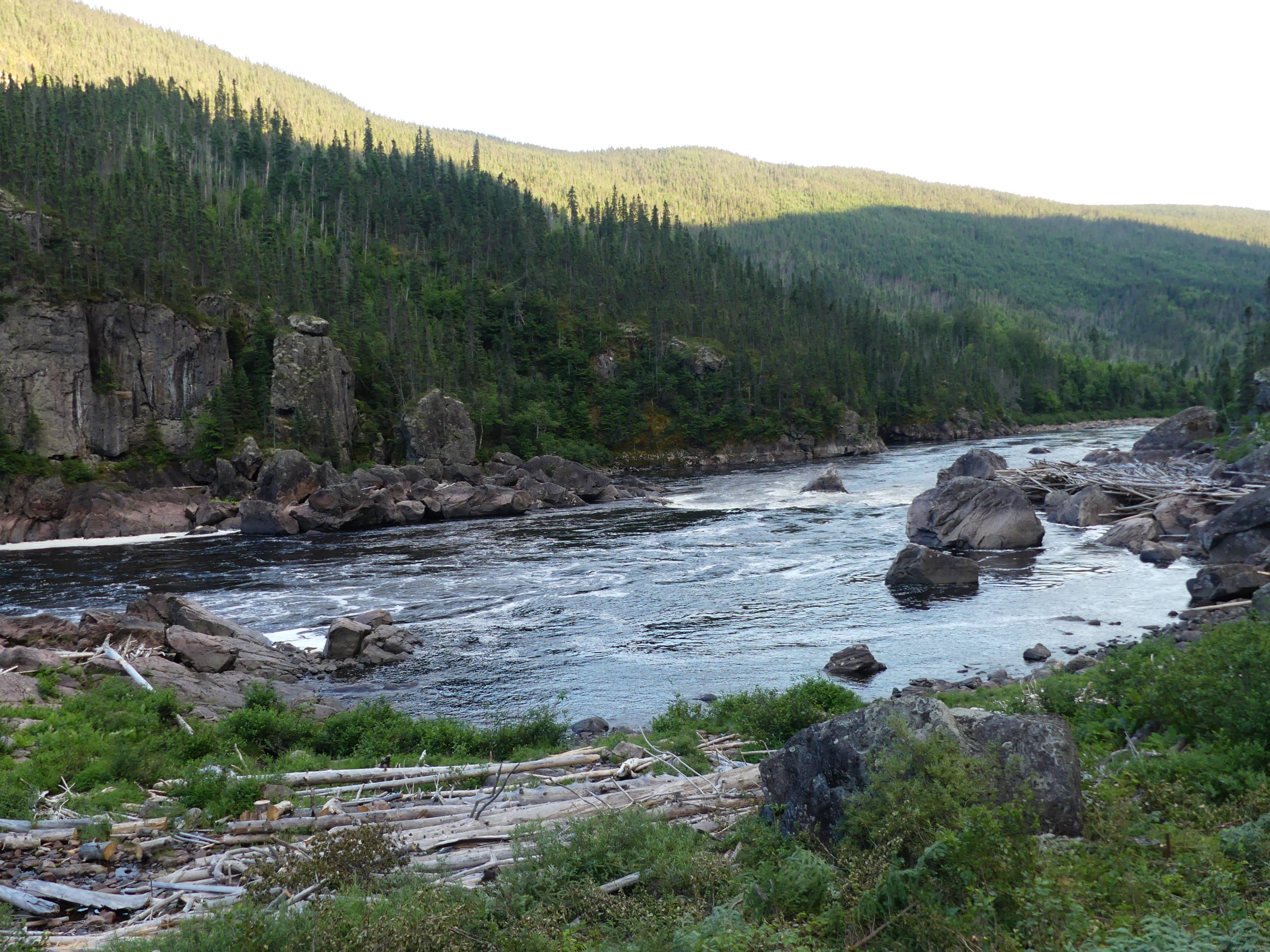
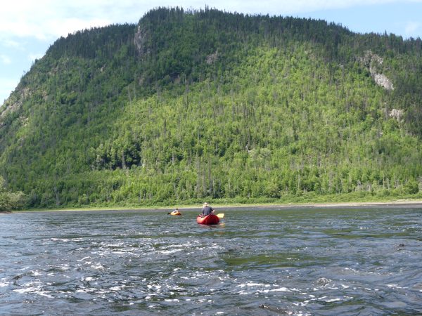
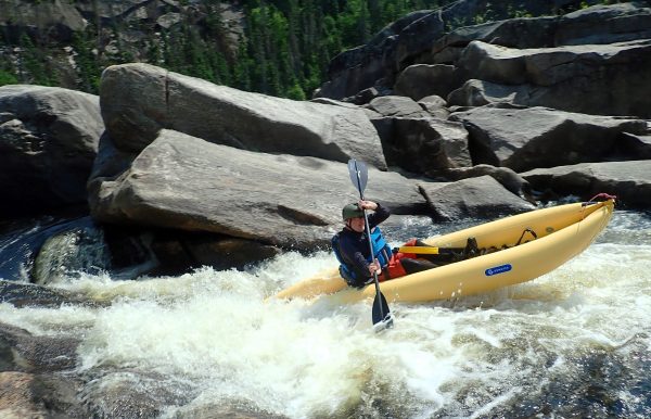
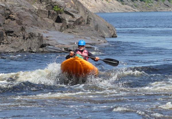
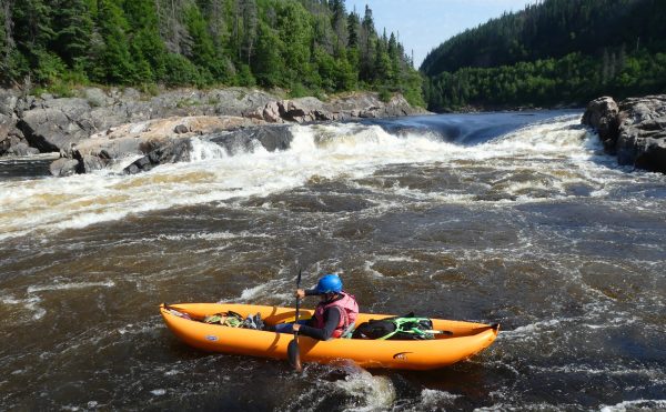
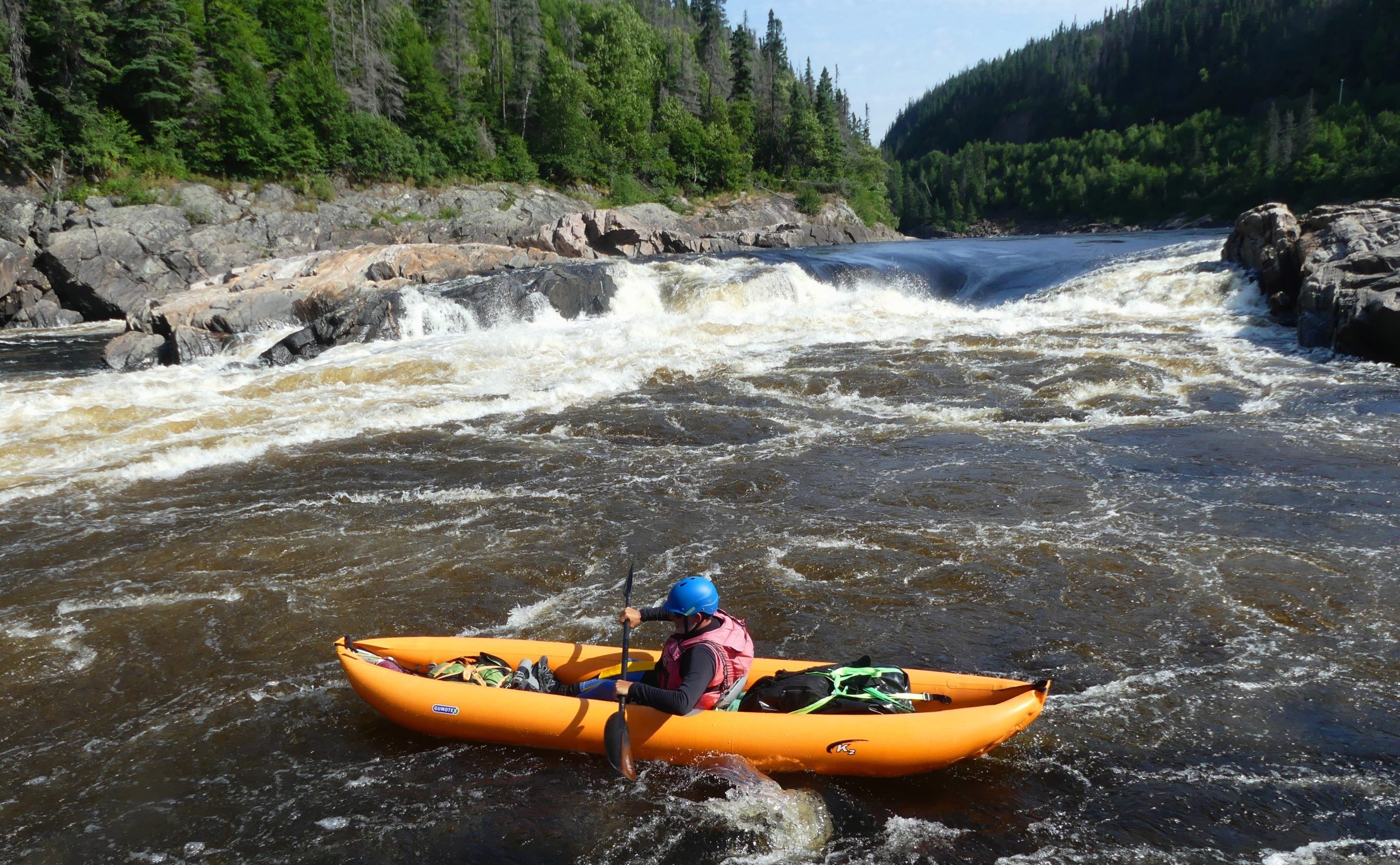
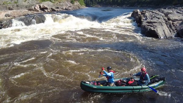
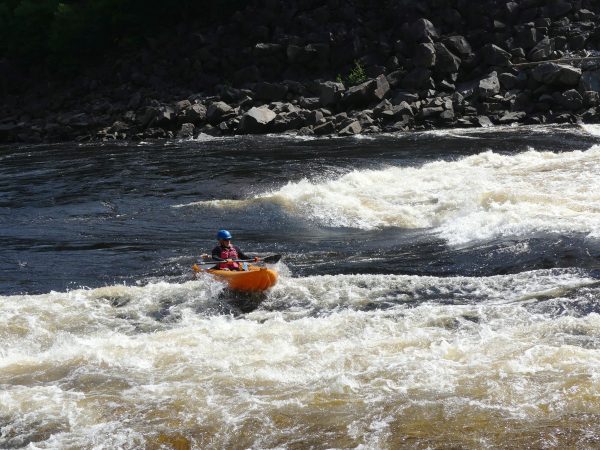
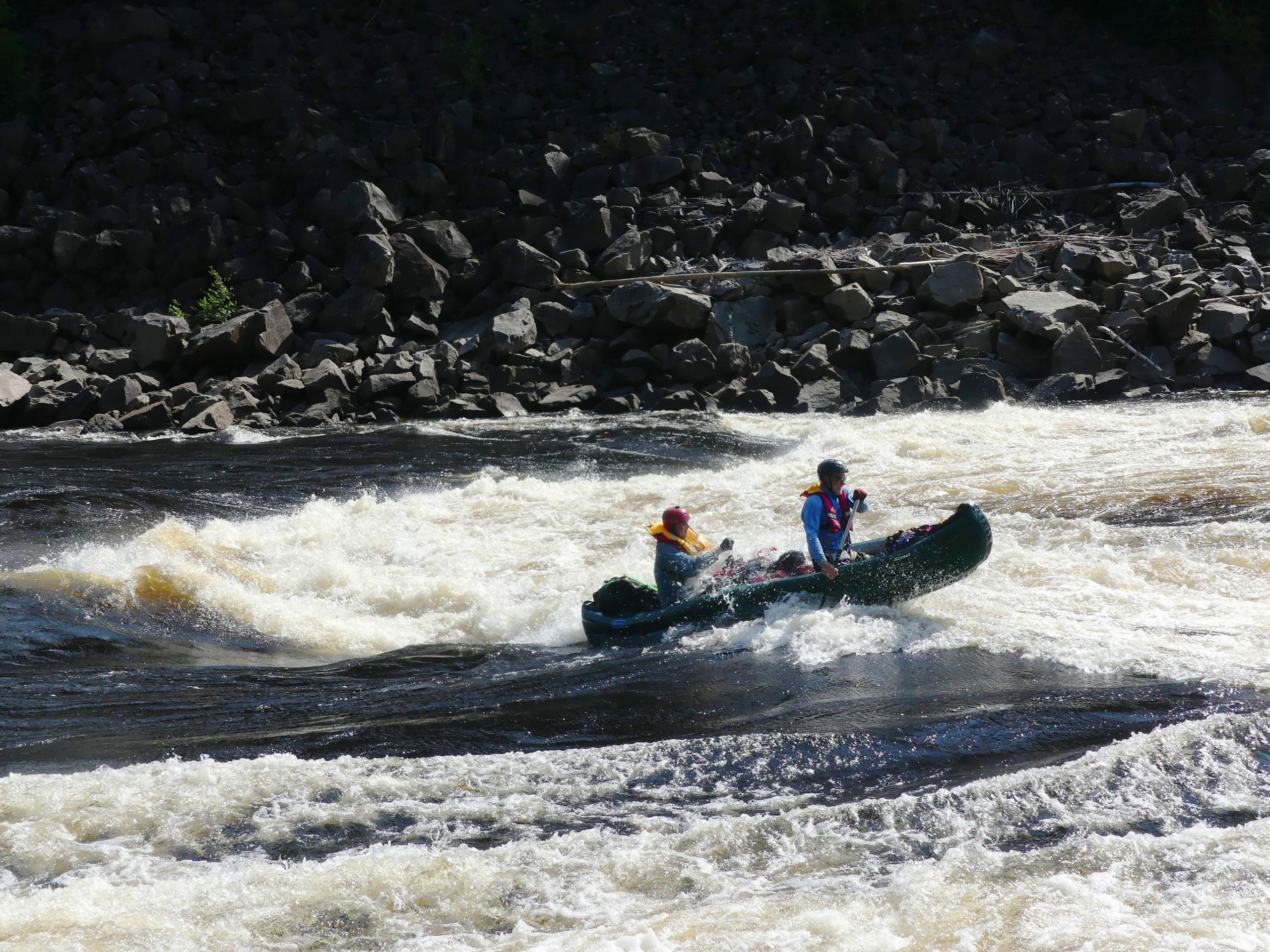
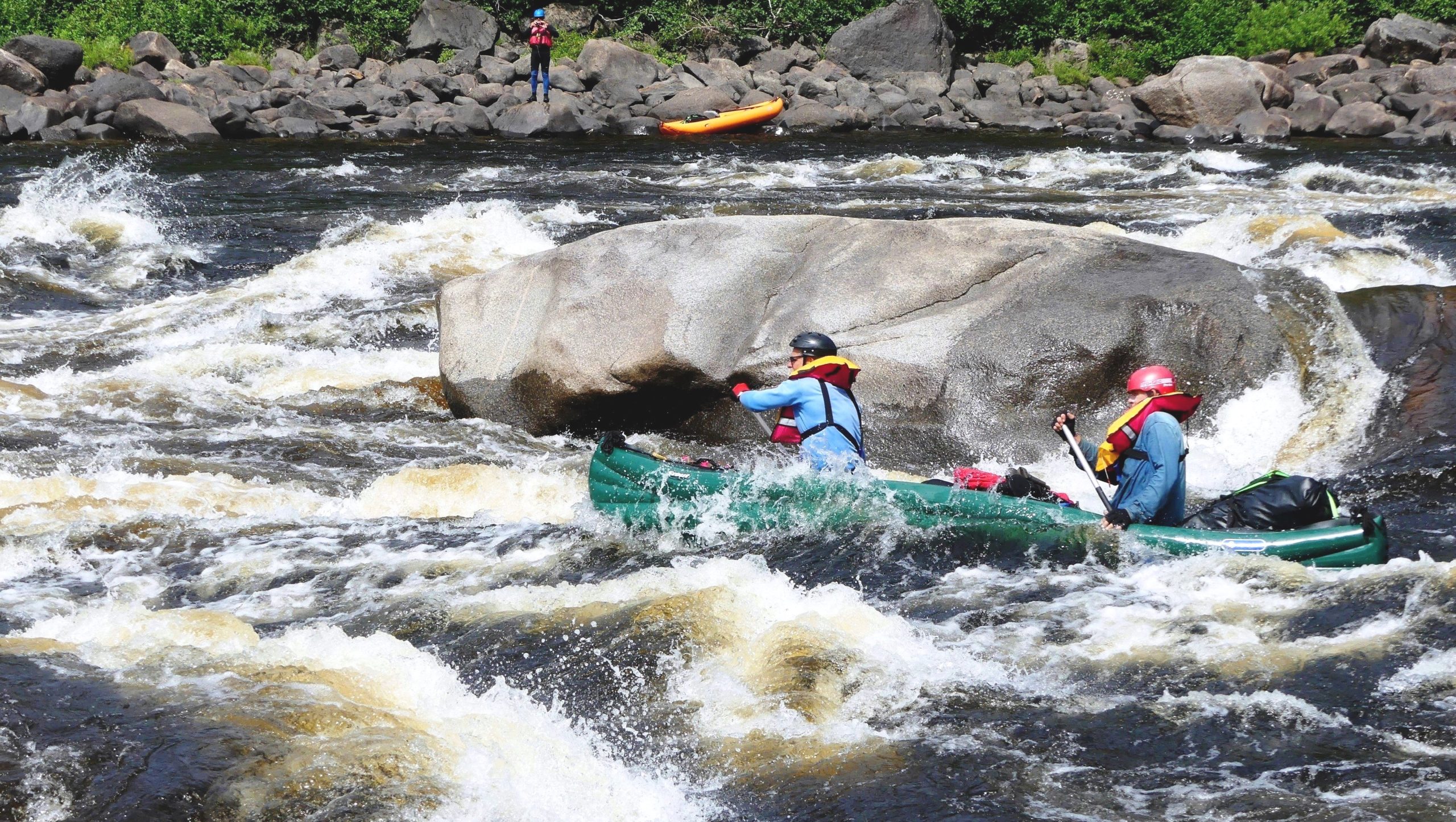
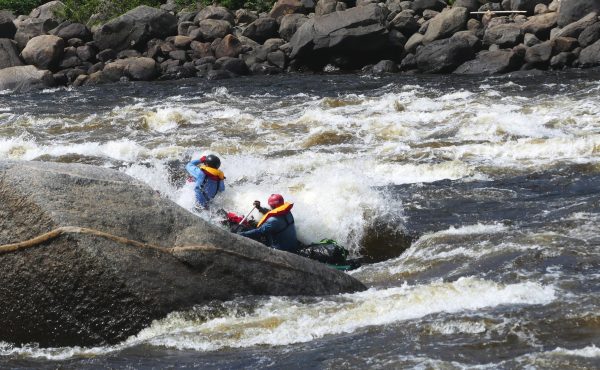
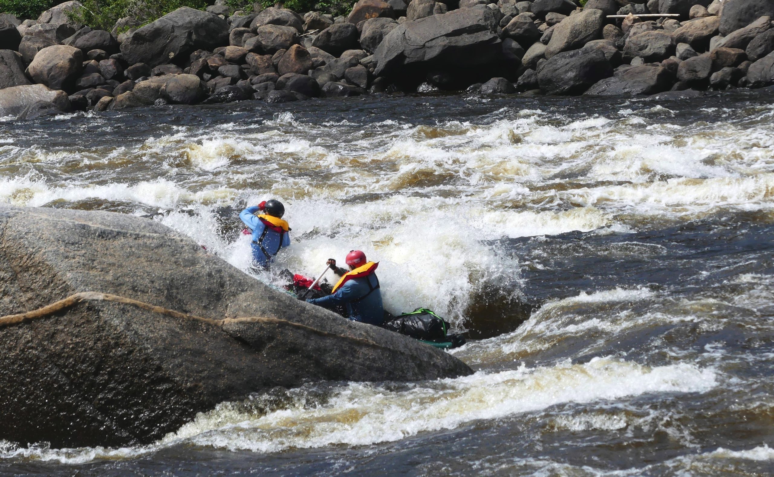
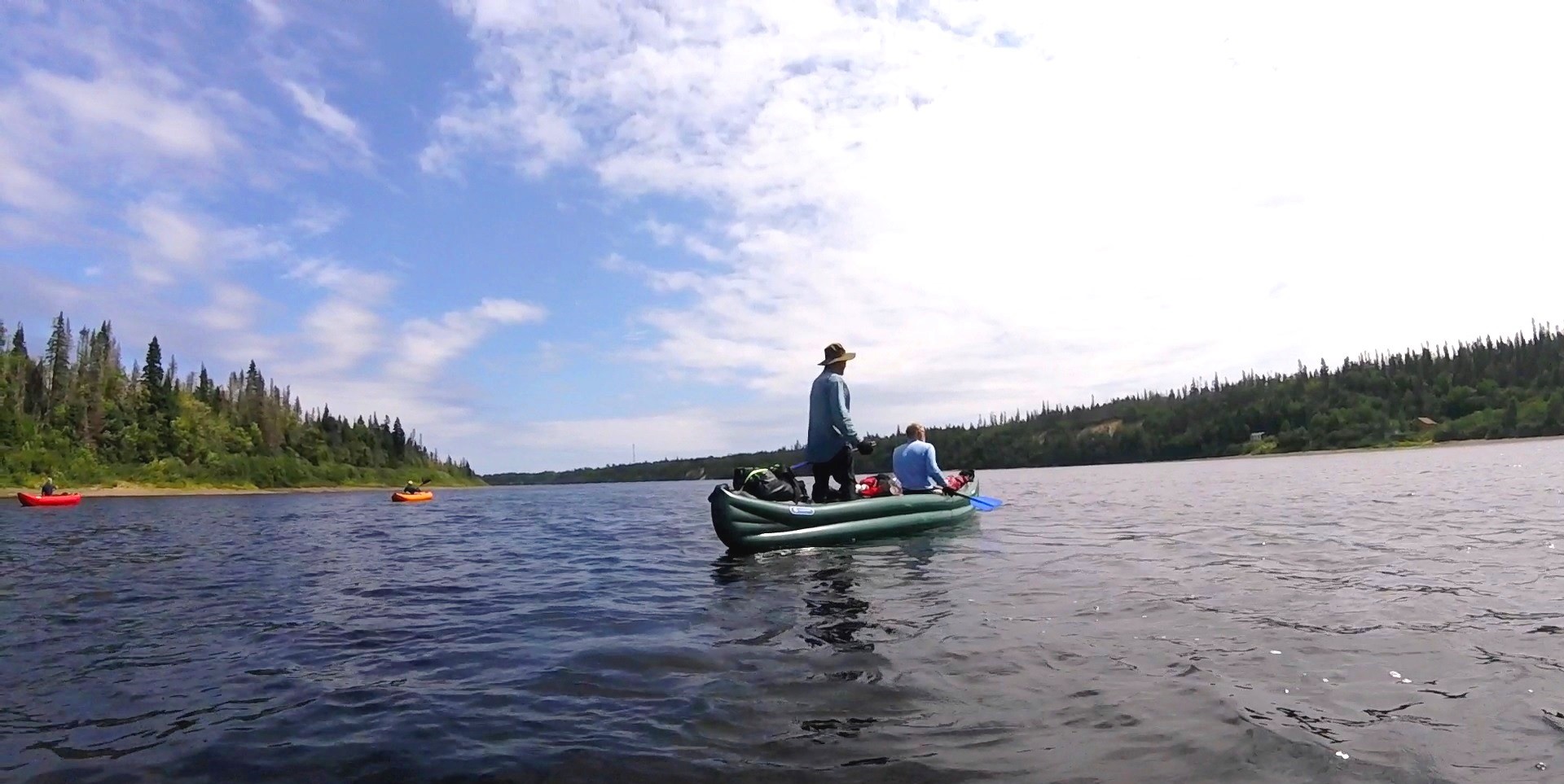
Further downstream we are entering in a long section of whitewater where the Moisie will offer to us some 10 rapids and drops from R3 to R5 during 8 kilometers. It takes a good hour to get to scout all the arms of the first big one, rated “R5” (grade-5 rapid) on our maps. Despite the first part of the thing was runnable by a small arm far on the right, a drop after the first 150m was barred by a strainer and unrunable. We decided to “portage” the all thing on the left, ignoring that this carrying track would be 450m long and will take two hours of astunning work through the bush and over granite slabs… Only Pierre decided to embark right after the entry drop and ran the rest successfully. At the second “big-one”, we ran the top small chute close to the right bank, but decided to avoid the following drop that crashes against a vertical boulder, by a “valise” – a very short carry of the boat by the bank without unloading the luggage – Finally, we can re-embark and paddle the rest of the enormous rapid, where at this point the river flows over 100 m3s, creating our first big waves and large holes.
-

- Inflatable kayaks and canoes on the Moisie River
-

- Inflatable kayaks and canoes on the Moisie River
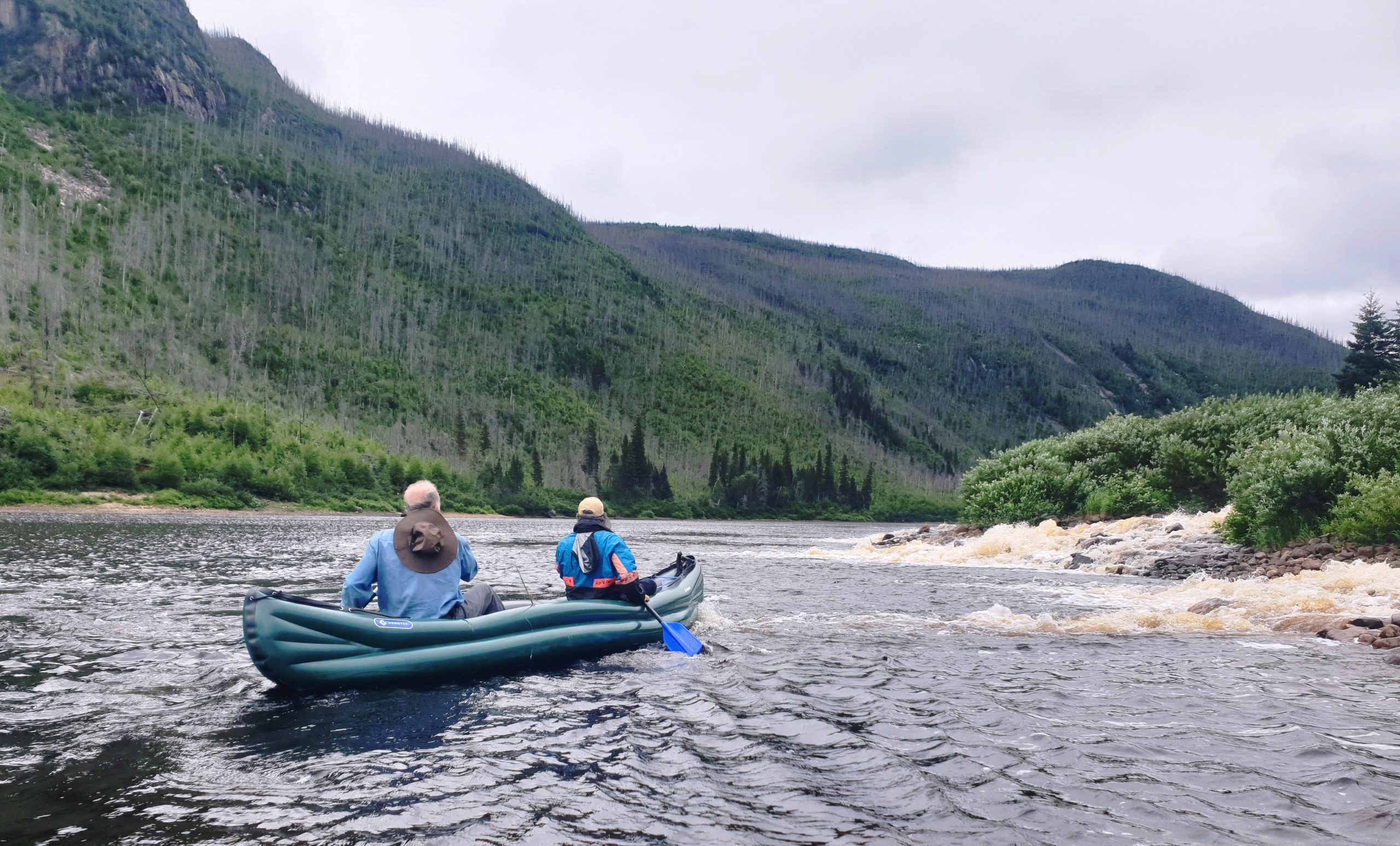
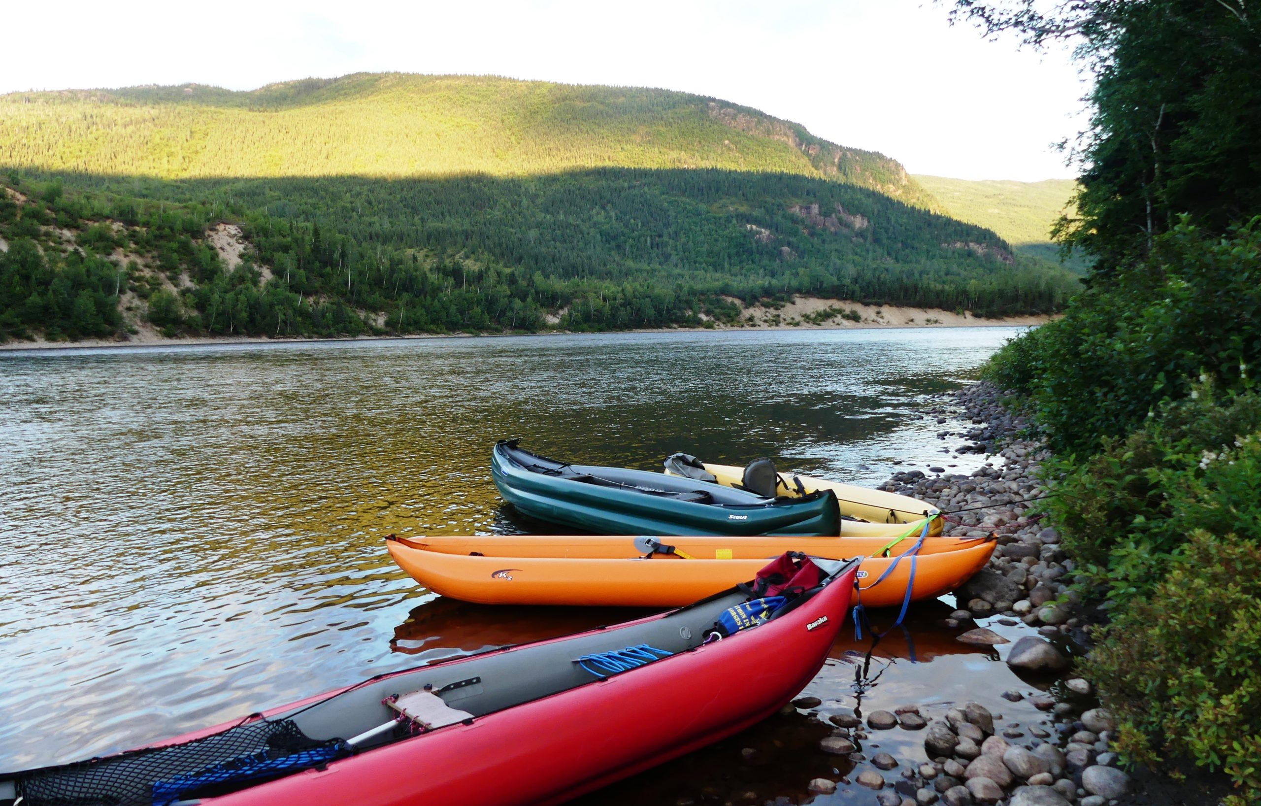
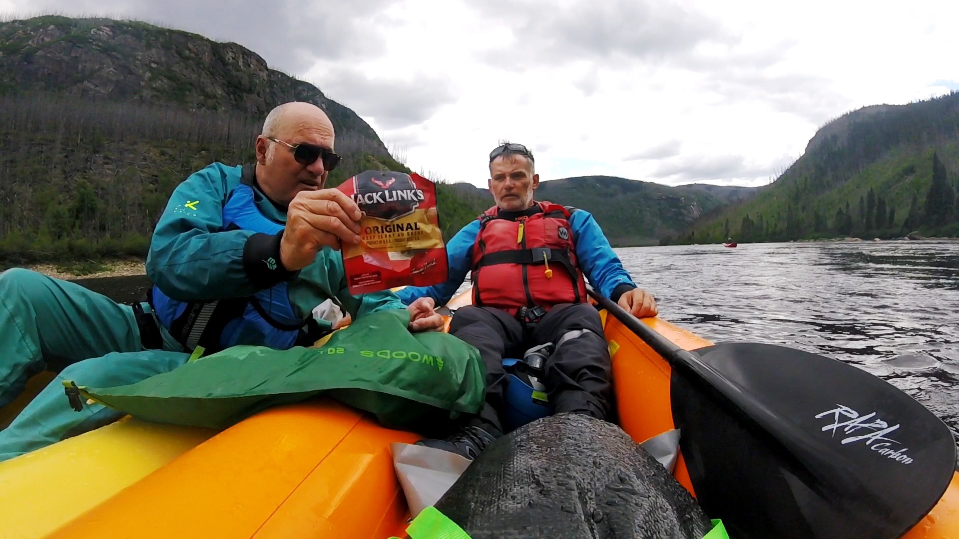
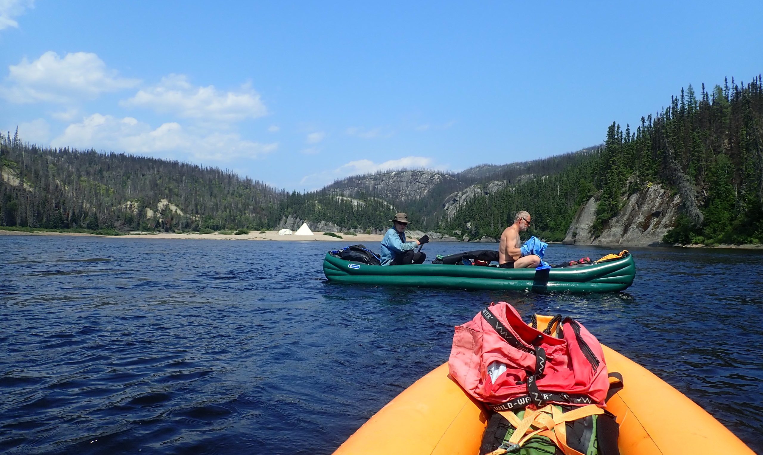
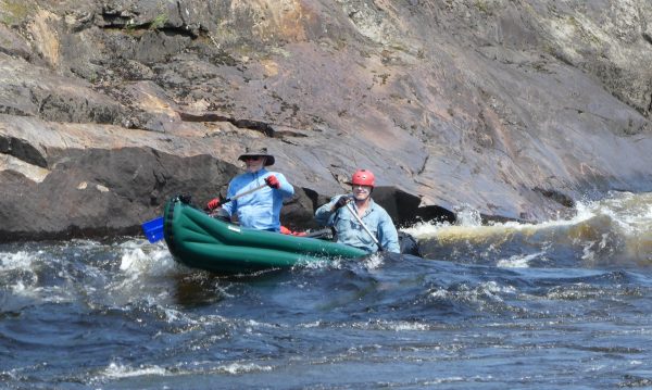
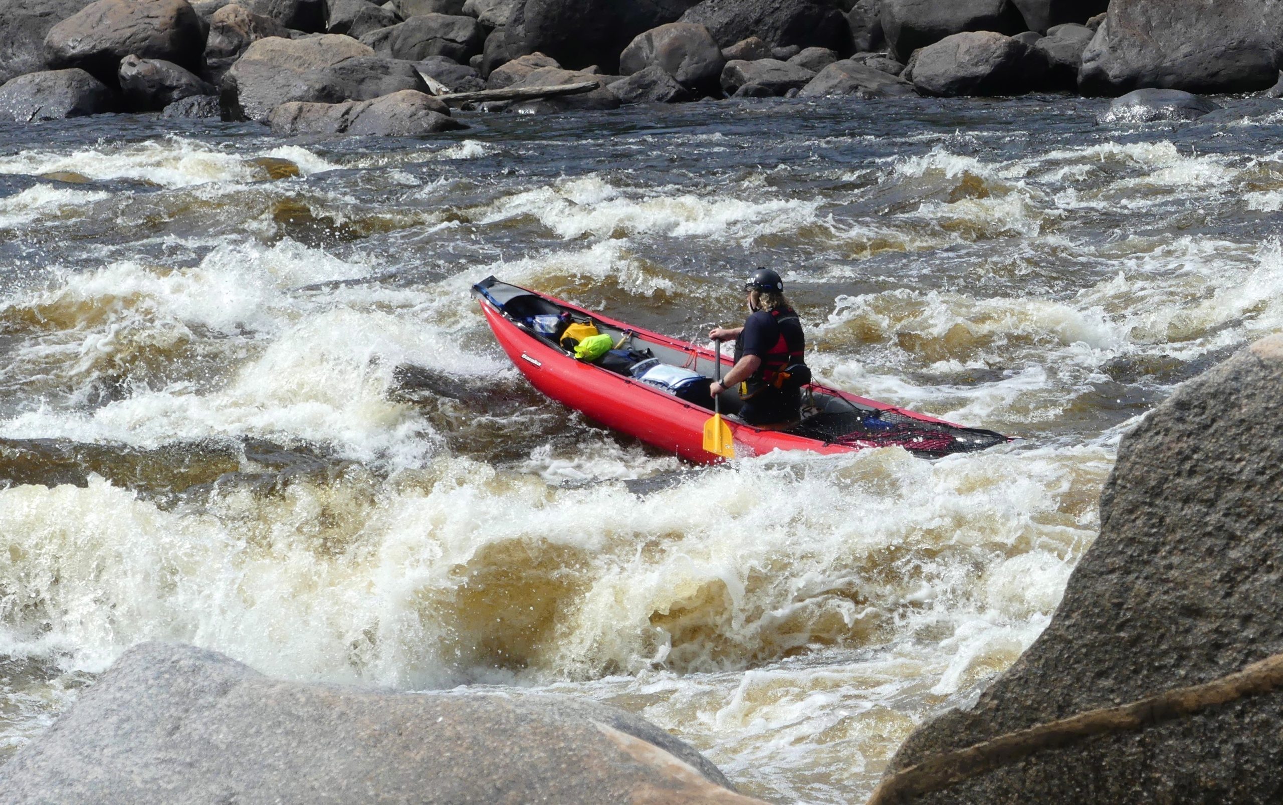
Our two “K2s” (Pierre and Laurent) are loaded with around 25 kg of gear, including our freeze-dried food and food supplements, minimal sleeping gear and photo-camera-charger-battery equipment. The “Brothers” Scout C2 is loaded with more than 60 kg, given that they left 12 days before on the head-lakes of the Moisie-sources, …and given the considerable weight of non-freeze-dried, i.e. canned, food … it weighs a lot! Olivier’s Baraka is loaded with around 40 kg (as Olivier also started 12 days earlier on the lakes… with extra food!). V ORIGINÁLE CHYBÍ, KLIDNĚ NECHME
One “S4” – grade 4 drop – is run in the right arm. Another “S5” – grade 5 drop or very steep short rapid – a “S4”, and a final long R5 rapids are run successfully.
-
- Inflatable kayaks and canoes on the Moisie River

-
- Inflatable kayaks and canoes on the Moisie River
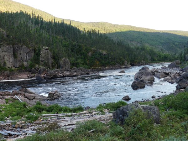
Then the Moisie will receive large tributaries during the next av. 100 km, whose spectacular waterfalls we visit (and fish), and where the river reaches a respectable flow of 200 m3s (7000 cfs) and a width of 50 to 100 m. V ORIGINÁLE CHYBÍ, KLIDNĚ NECHME
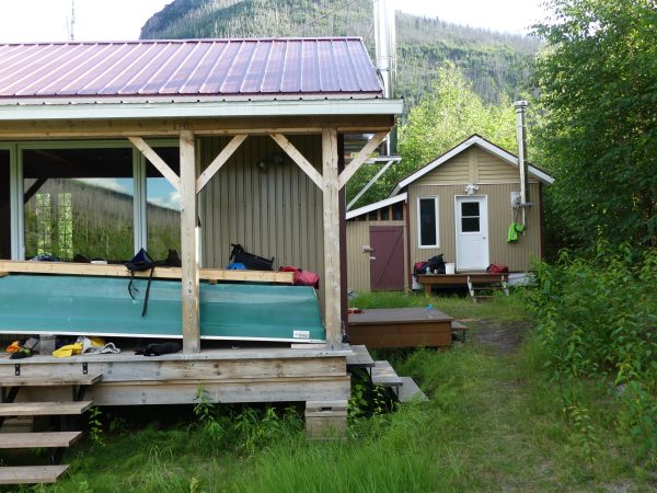
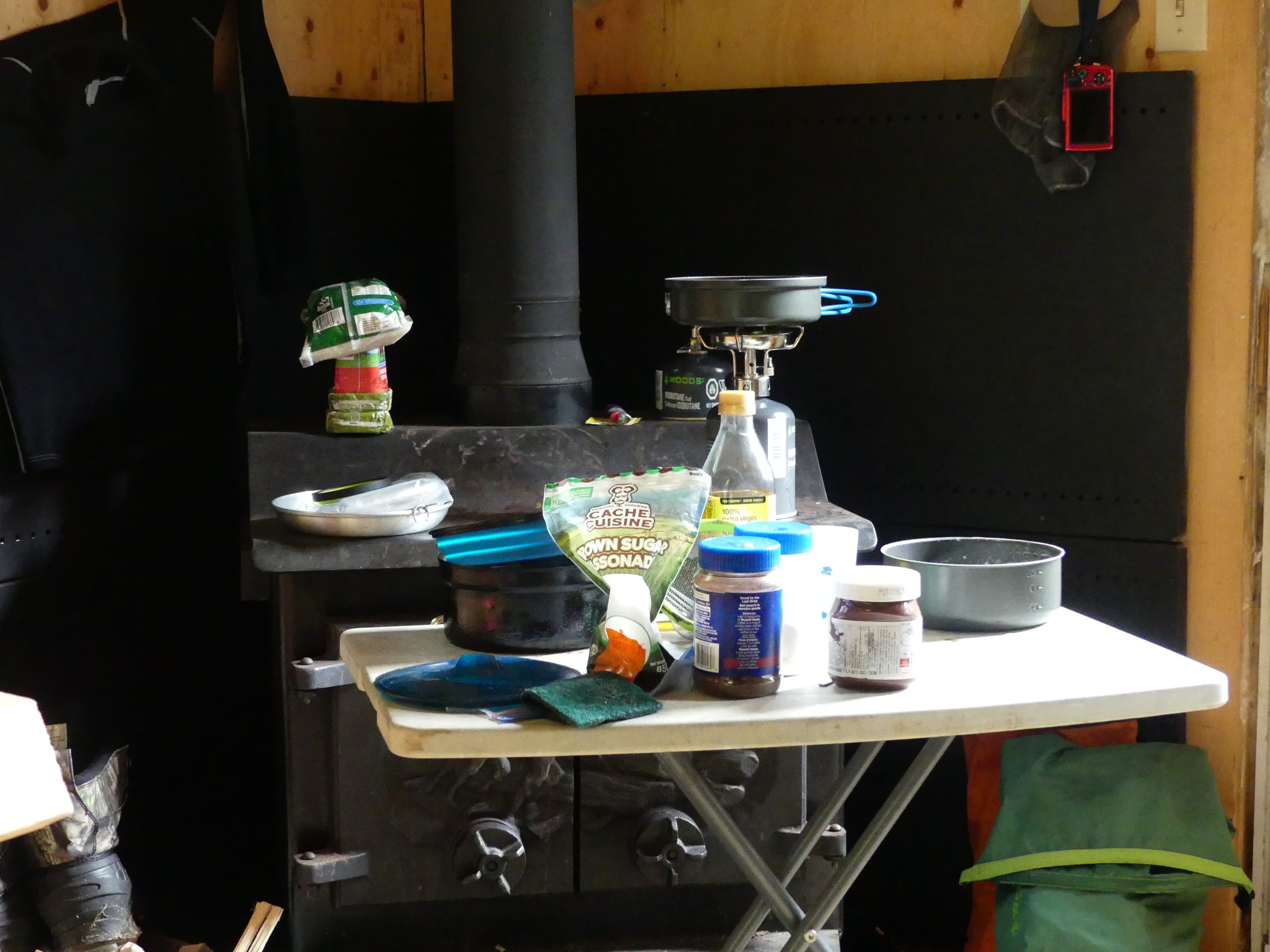
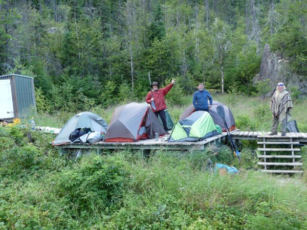
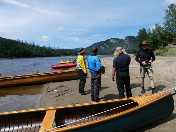
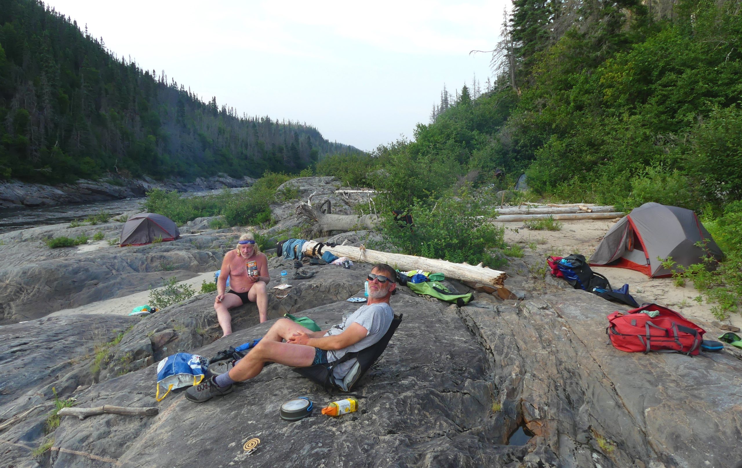
At km 210 of the Moisie, an unlikely cabin given the total absence of an access road: the “Shack-A-Bernie” ! The owner Bernie, a trapper and hunter in his spare time, has renovated his main cabin and dedicates the old one to visiting paddlers! Eternal gratitude to you Bernie, for this refuge where we arrived soaked and sweaty… and where we stayed for two days to recover!
-

- Inflatable kayaks and canoes on the Moisie River
-
- Inflatable kayaks and canoes on the Moisie River

-

- Inflatable kayaks and canoes on the Moisie River
-

- Inflatable kayaks and canoes on the Moisie River
The next two days, July 23 and 24, are the “falls section”. We start with a long paddling session through a wooded gorge once burnt by fires – rarely controlled, given the remoteness and lack of access points. The biggest rapids on this section, a R3/R4 at km 199, is easy to paddle thanks to its “chicken-shots” against the left bank.
We take our lunches on the water to take advantage of the current, which carries us along quickly despite the flats. More elaborate lunches for the scout’s bowman (one of the Brothers who has categorically refused the freeze-dried-food that are the basis of the rest of the group’s diet, and has taken along nearly 30 kg of pasta, rice and various canned food).
-
- Inflatable kayaks and canoes on the Moisie River
-
- Inflatable kayaks and canoes on the Moisie River
-

- Inflatable kayaks and canoes on the Moisie River
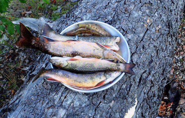
The Caopacho River brings us 25 m3s at km 173. A compulsory stop to track down the local wild trout, which prefers the more oxygenated waters of the tributaries. Pierre Dabout will fish his way up the Caopacho to the foot of its spectacular falls. Caopacho trout: a welcome dietary supplement!
At km 167, the spectacular waterfalls of the Fontarabie lake outlet are in sight. Mandatory stop to track the trouts in the 15 m3s tributary, providential for our supplementary dinner!
-
- Inflatable kayaks and canoes on the Moisie River

-
- Inflatable kayaks and canoes on the Moisie River

-

- Inflatable kayaks and canoes on the Moisie River
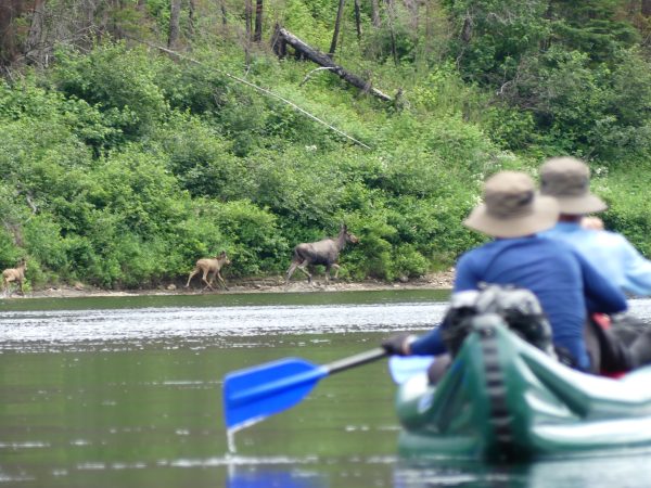
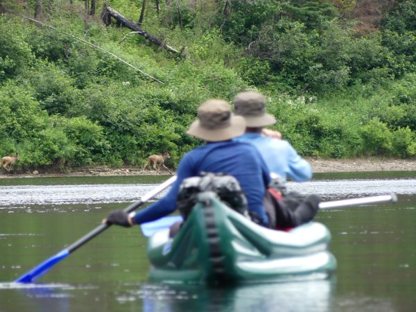
The scoop of the day: a Moose mother and her two youngsters, whom I was lucky enough to catch with the brothers’ canoe in the foreground! The second youngster trailed off to hide, and I wondered how many of them had already been seen on the banks!
-
- Inflatable kayaks and canoes on the Moisie River

-
- Inflatable kayaks and canoes on the Moisie River

-
- Inflatable kayaks and canoes on the Moisie River

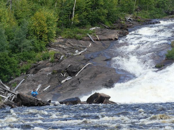
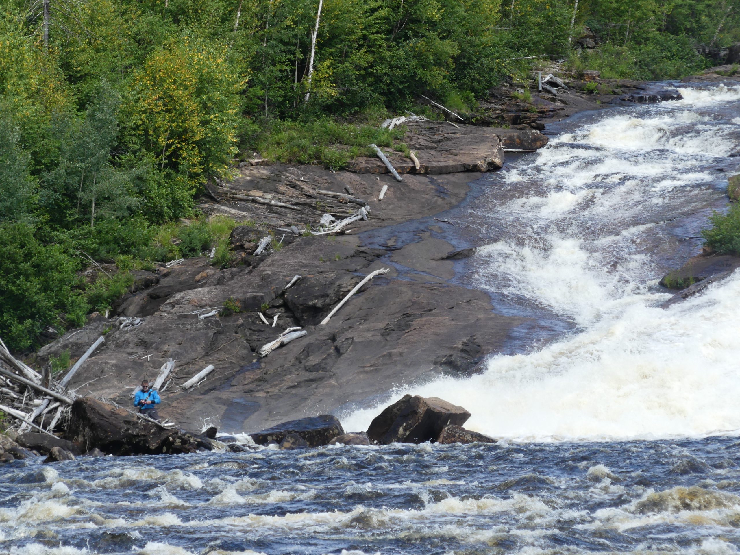
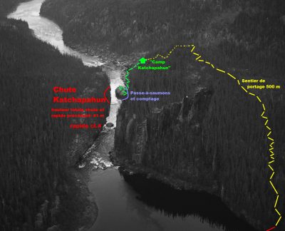
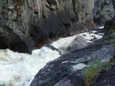
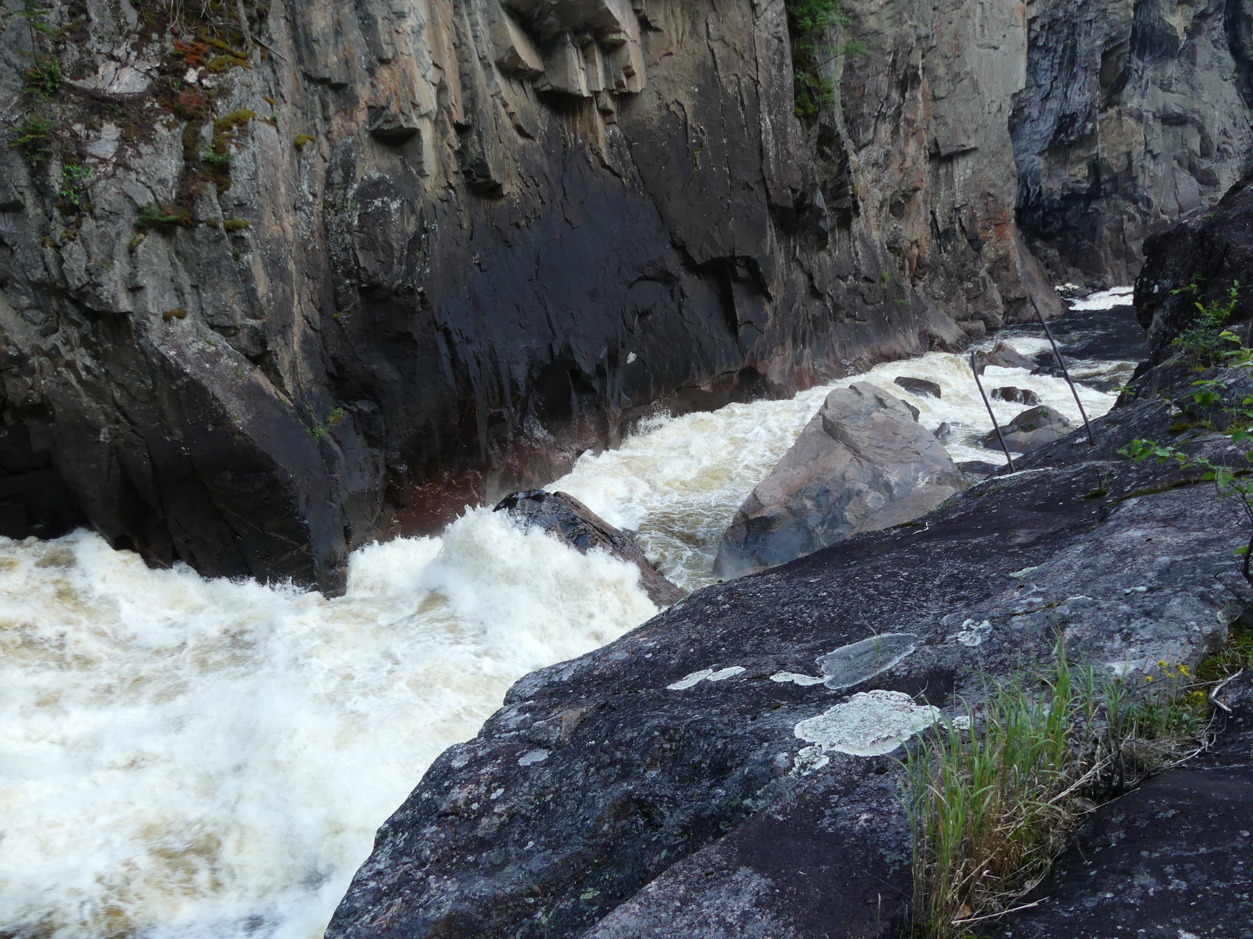
After a long, flat stretch where the current slows down, here comes the Moisie’s main obstacle: the “KATCHAPAHUN” falls, that we would discover after a gruelling 500 m portage. Ascent of about 100 m elevation following the portage trail to the top of the rocky bar on the right bank, under clouds of hungry black flies – head mosquito net essential, but almost unbearable because of the sweat on this climb… Then we visit the bottom of the falls and the “Fish-pass” installed in 1976 by the APRM and the Quebec government for the Atlantic salmon – the aim: to increase salmon populations on the Moisie by promoting upstream spawning grounds – you can imagine the cost of this installation, when you knows that the only means of access to this site is by helicopter!
-
- Inflatable kayaks and canoes on the Moisie River

-
- Inflatable kayaks and canoes on the Moisie River
-
- Inflatable kayaks and canoes on the Moisie River

-
- Inflatable kayaks and canoes on the Moisie River
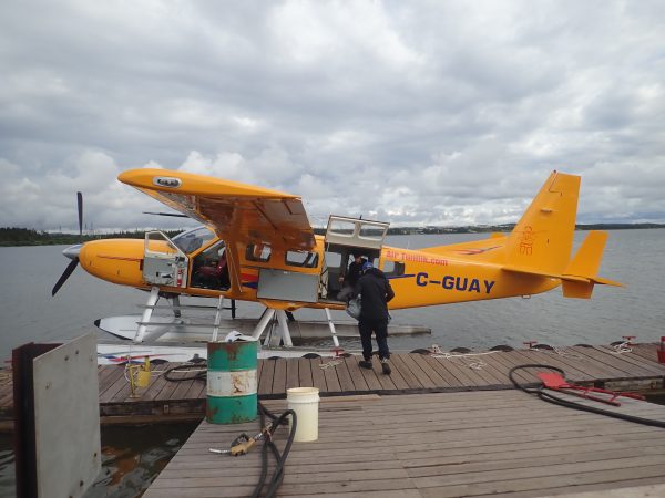
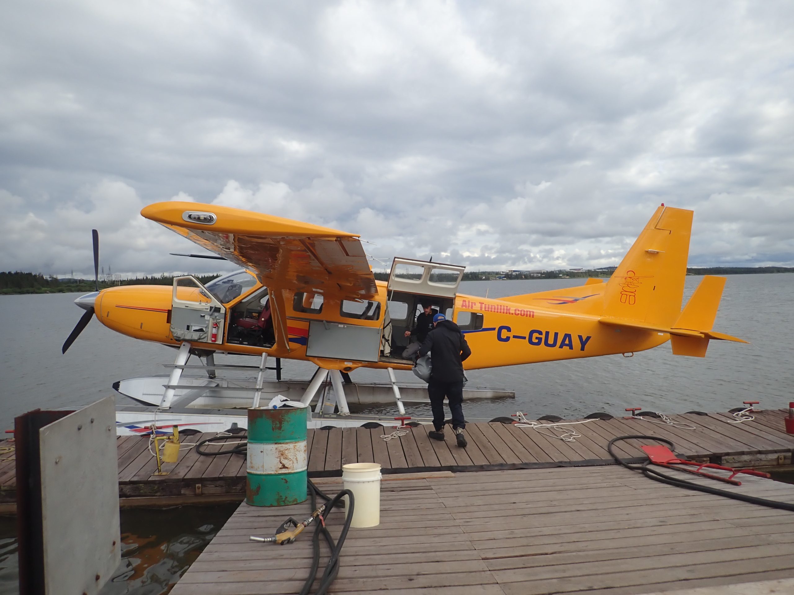
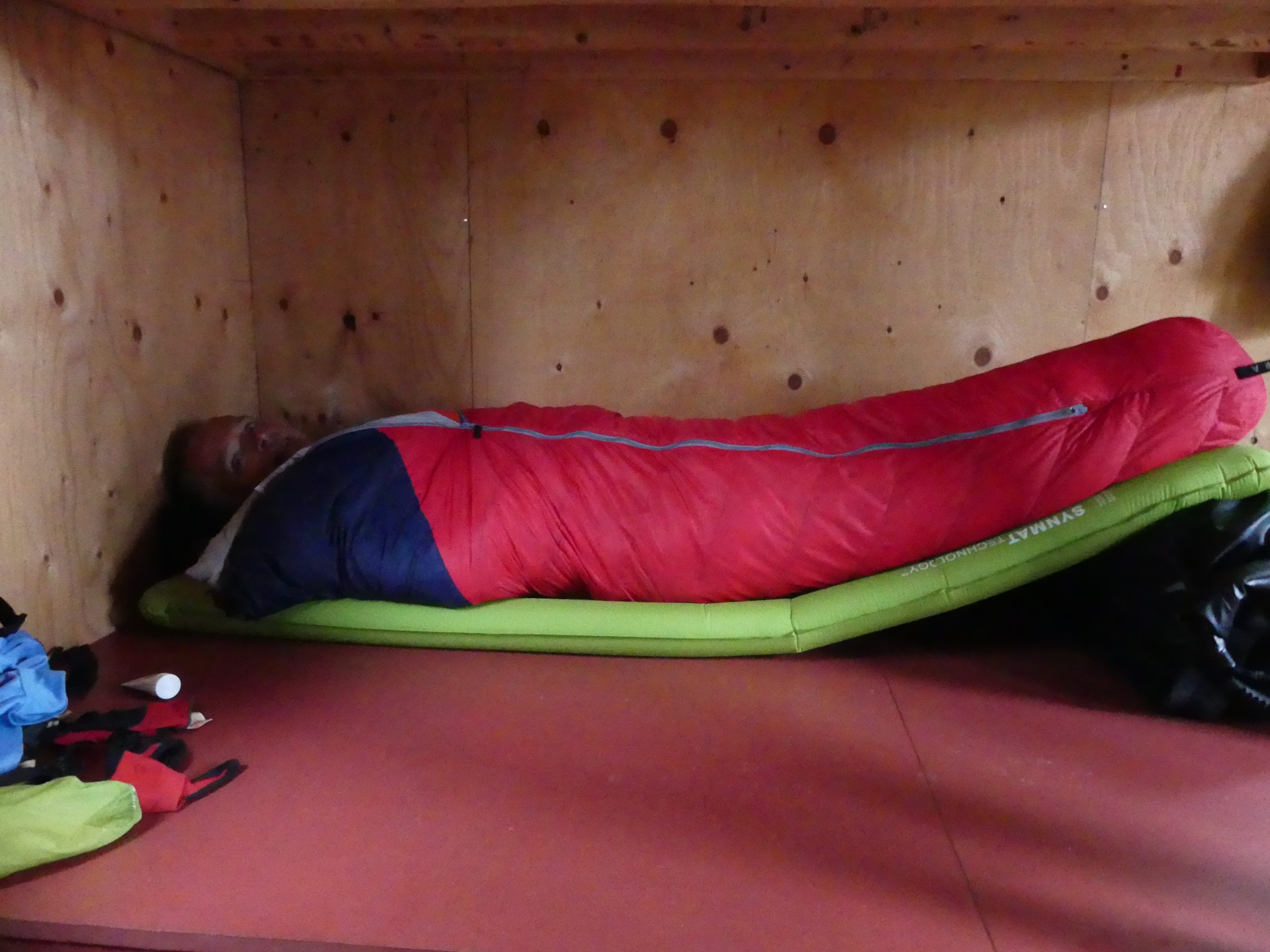
At the portage trail end, we find another unlikely cabin: “Camp Katachpahun” is the summer home of two APRM staff whose job is to count the salmons ascending the Fishpass. Francis and Alex will take us on a tour of the waterfall and fish ladder, and explain everything we need to know about the site. Access to the area is only by helicopter from Sept-Iles, 145 km away, average round-trip cost is 3,000 Canadian dollars.
The place is so rocky and steep that the only possible place to pitch our tents will be on the helicopter platform (with the guidance and permission of Alex and Francis, who understood that we were too exhausted from the portage to re-board and find a lower camp – eternal gratitude to them!)
-
- Inflatable kayaks and canoes on the Moisie River

-
- Inflatable kayaks and canoes on the Moisie River
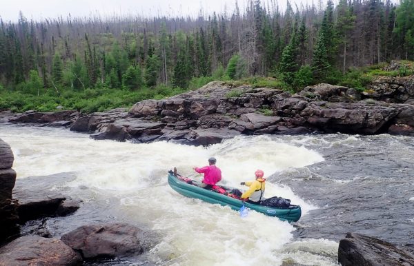
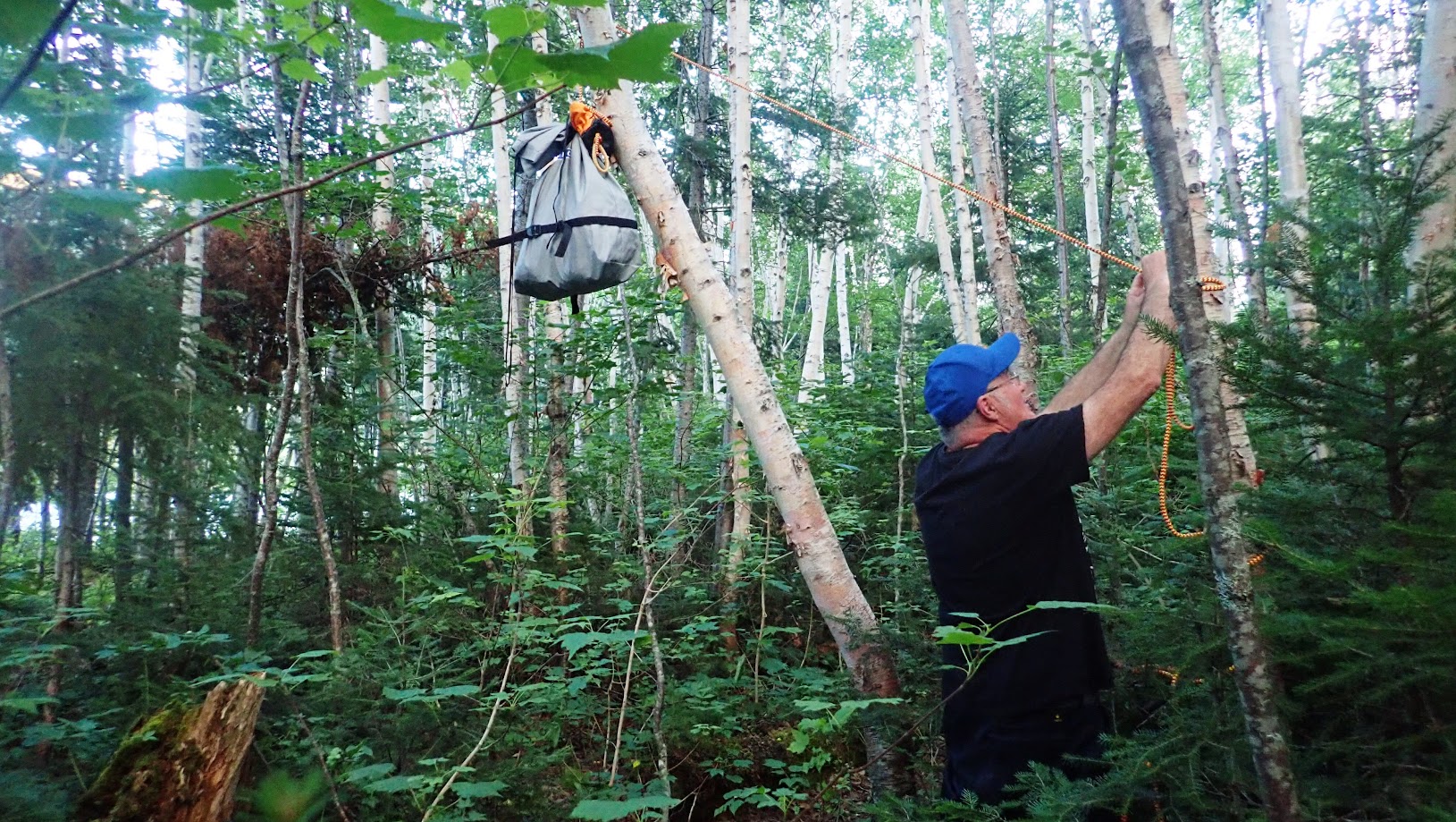
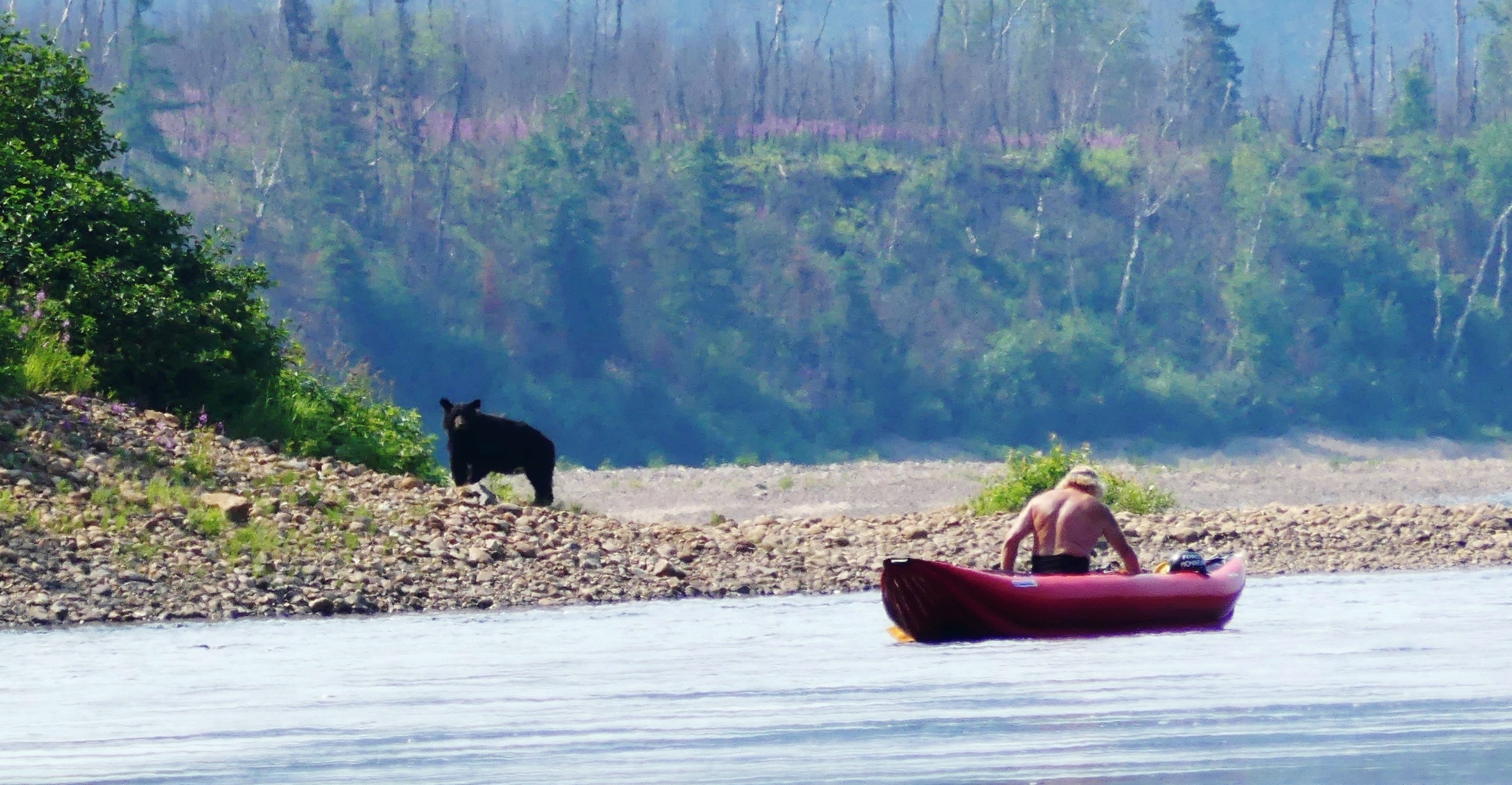
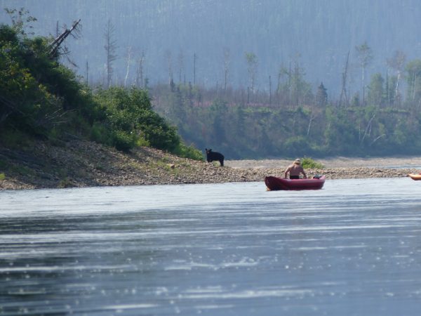
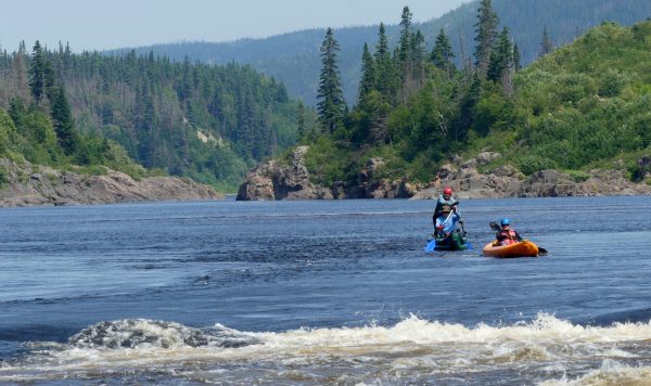
From km 145 to km 65 – 80 km in 3 days. Only ten rapids, rated R1 to R3, animate this long section, but continuous small slope breaks form “riffles” and provoke a strong and continuous current averaging 6 kilometers per hour. Fortunately, we have some great encounters: Baribal bears (Black-Bear), brook trout, and 4 “pourvoiries” (fishing camps), all but one abandoned or deserted.
-

- Inflatable kayaks and canoes on the Moisie River
-

- Inflatable kayaks and canoes on the Moisie River
-
- Inflatable kayaks and canoes on the Moisie River

-

- Inflatable kayaks and canoes on the Moisie River
-
- Inflatable kayaks and canoes on the Moisie River

-
- Inflatable kayaks and canoes on the Moisie River

At the “pourvoirie Wapetec”, we meet a fishing-guide preparing the cabins and the outfit for a next fishermen group, and we have a look at the canoes used by the guides to take Atlantic salmon anglers to the “pits” of the Moisie River – the river has a rather calm profile with no major rapids for some twenty kilometers, which enables the guides to get upstream thanks to powerful engines and the profile of their canoes designed for speed. Cost of outfitting: cabins with all comforts, one guide for two anglers all day, full board – Can$ 1,000 per person, helicopter access from Sept-Iles not included ($ 3,000 per trip).
A superb Black Bear is dislodged by Pierre and Olive in their boats. Paddling 100 m upstream, I have time to snatch my Lumix from its watertight case and zoom in just before it takes off nonchalantly.
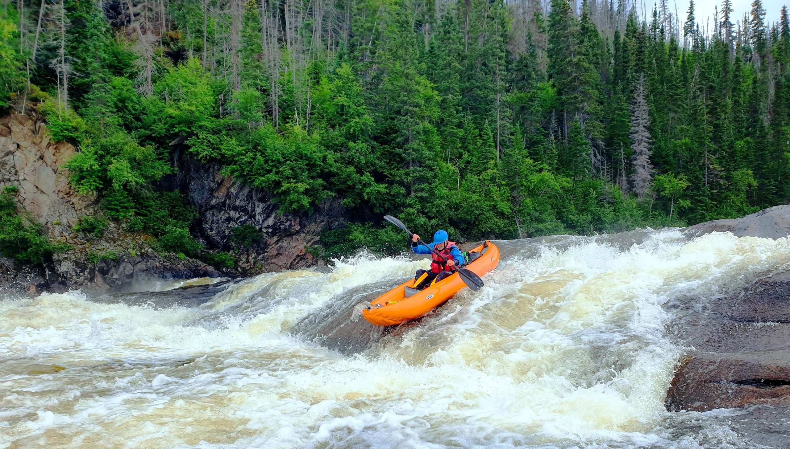
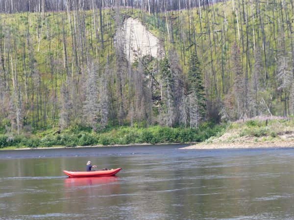
Alas, traces of the huge fires of previous years can still be seen for miles along the riverbank. We finally arrive at km 65, where a huge granite hill forces the river into a wide canyon, cut by a “grade 5” steep drop and rapid. We “chick” the big drop with a “Chicken-Shoot” on the right side of the canyon.
-
- Inflatable kayaks and canoes on the Moisie River

-
- Inflatable kayaks and canoes on the Moisie River

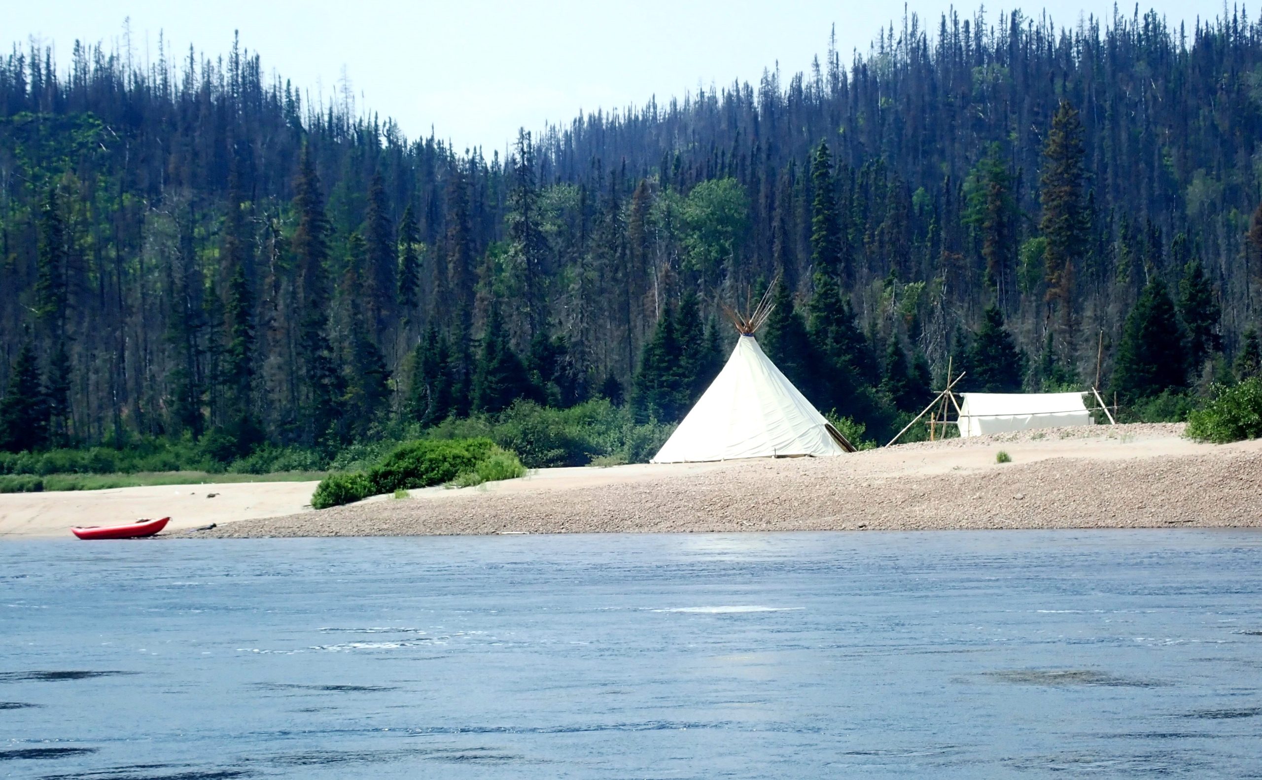
At the bottom we discover a huge “salmon pool” half a kilometer wide, an island in the middle where a teepee signals the presence of an outpost of the “Nipisis-Moisie” fishing camp, an outfitting operation run by the local Amerindian nation. We set off again for the last calm section (with a good current) to the final gorge, some 30 km downstream.
At km 55 we pass the confluence of the Nipisis River and the Moisie. From this point on, the summer flow rises to around 300 m3s (we’ll have exactly 291 m3s in the final gorge the next day). Between km 55 and km 32, at the entrance to the Gorge, the left bank is bordered by the railroad – almost invisible, but not inaudible.
-

- Inflatable kayaks and canoes on the Moisie River
-

- Inflatable kayaks and canoes on the Moisie River
After entering the great gorge and running the first R1 and R3 rapids, we set our last camp at km 32 up a slab with a spectacular panorama of the gorge. Hiking along the steep left bank we spend two hours for scouting a famous R5 rapid below.
-

- Inflatable kayaks and canoes on the Moisie River
-
- Inflatable kayaks and canoes on the Moisie River

-
- Inflatable kayaks and canoes on the Moisie River

-
- Inflatable kayaks and canoes on the Moisie River

-

- Inflatable kayaks and canoes on the Moisie River
-

- Inflatable kayaks and canoes on the Moisie River
The next morning under the R5, Pierre and I are at the end of our provisions and benefit from two lightly loaded K2s weighing between 15 and 20 kg in all. For Olivier, perhaps ten kilos less since his departure at km 412 on the headwater lakes, 23 days earlier! With their random stowage system, the Brothers’ Scout looks just as loaded as when they left 23 days earlier!
-
- Inflatable kayaks and canoes on the Moisie River
-
- Inflatable kayaks and canoes on the Moisie River

-
- Inflatable kayaks and canoes on the Moisie River

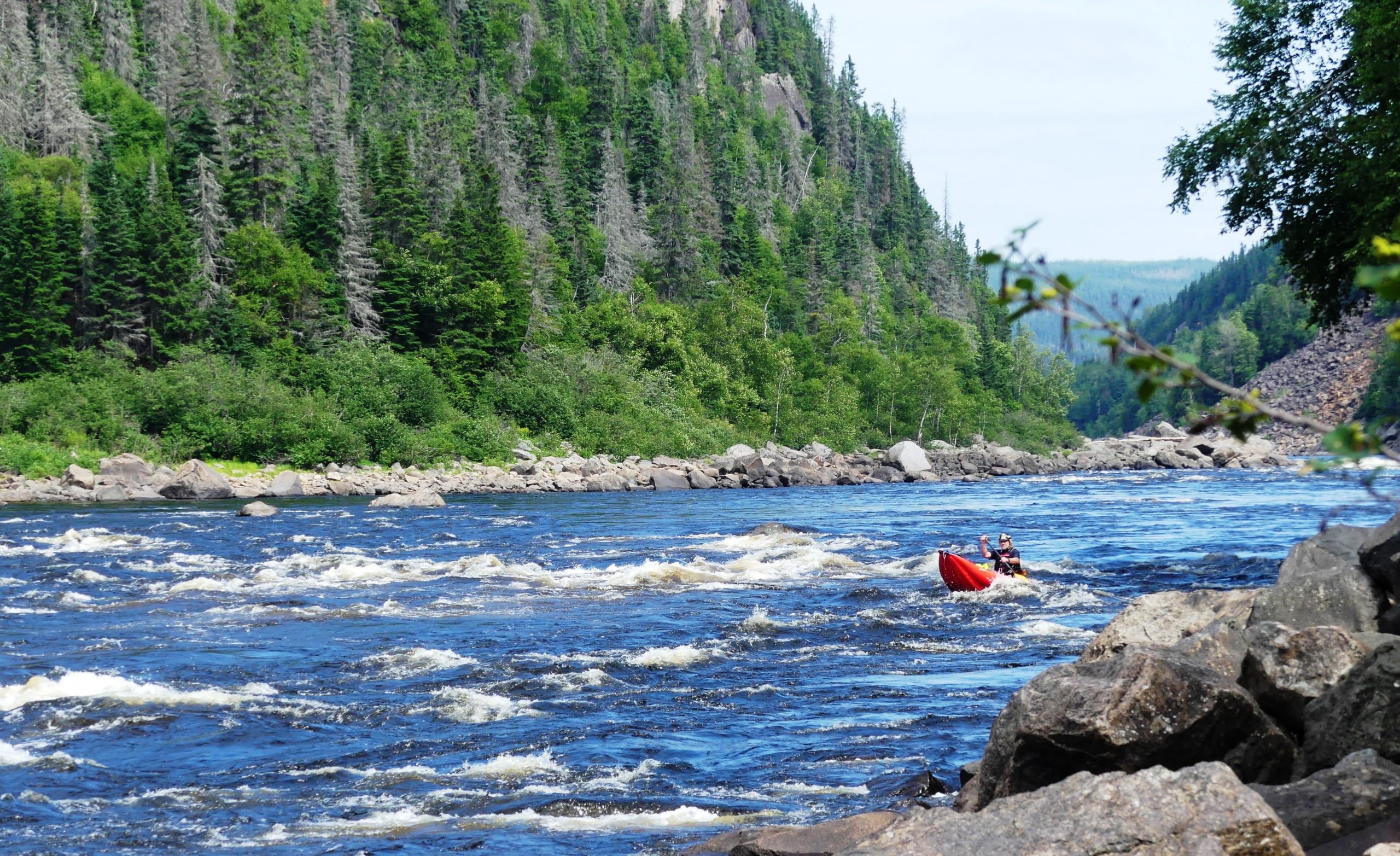
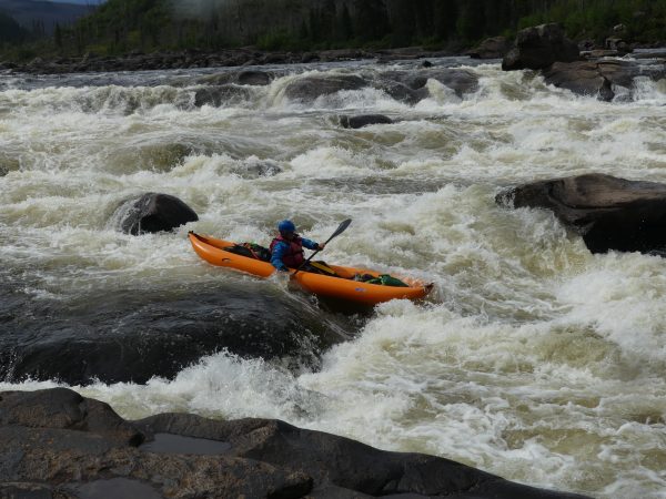
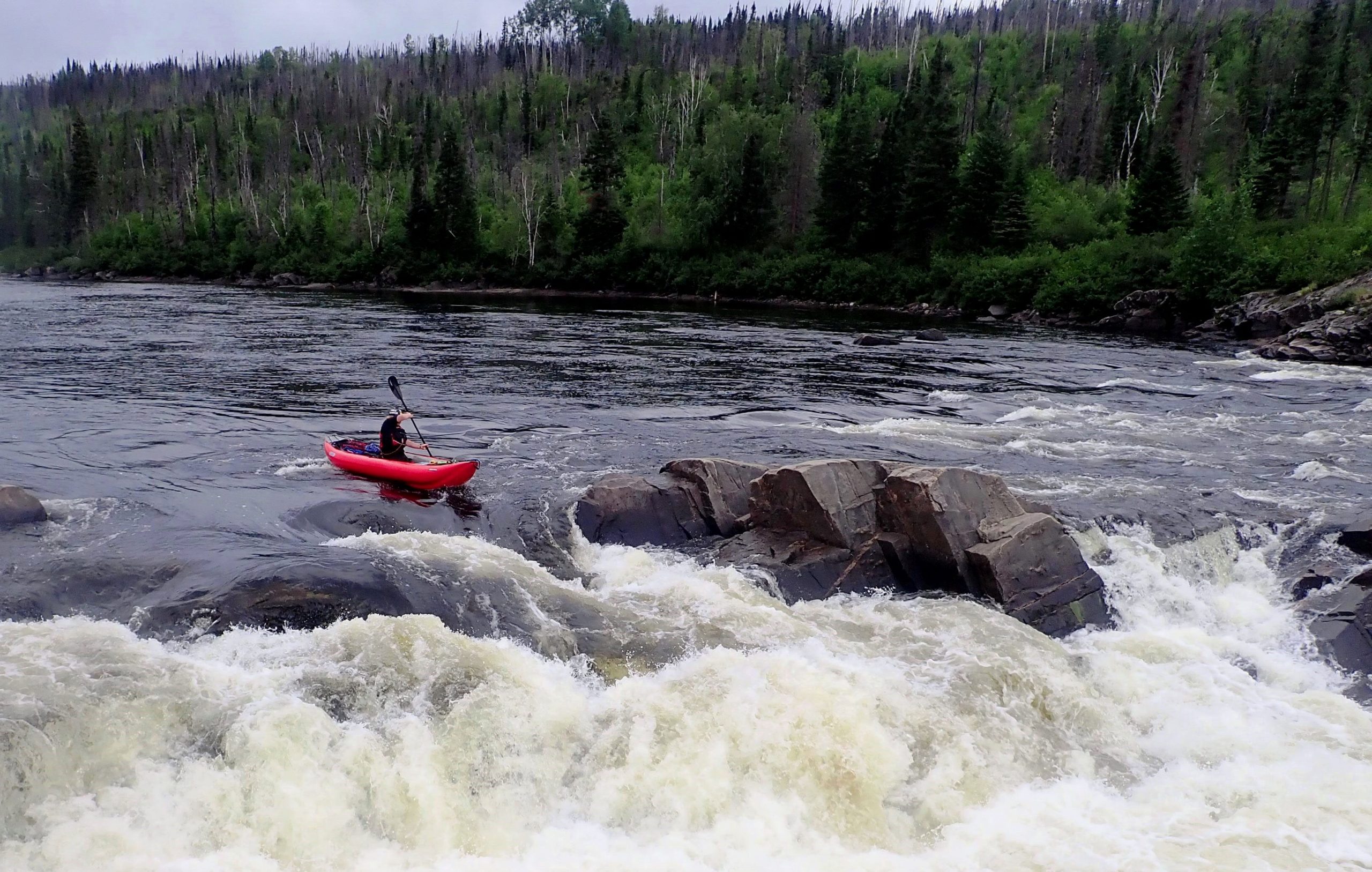
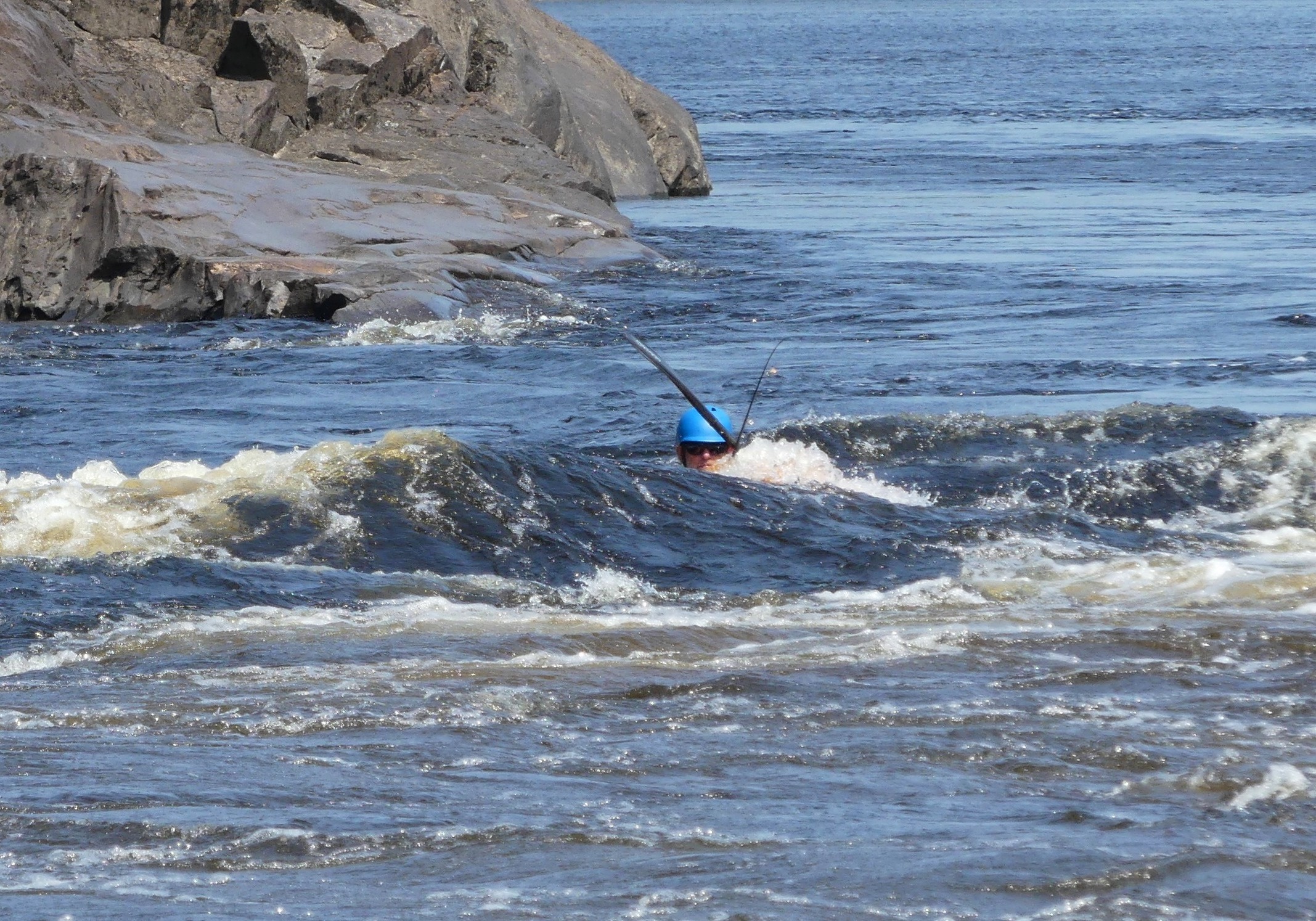
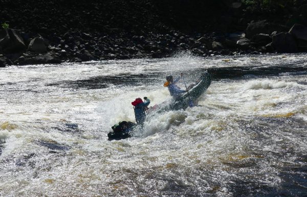
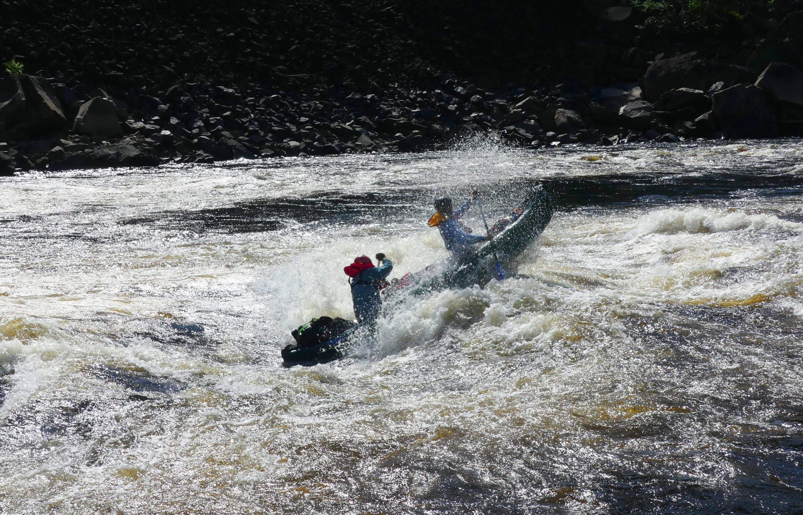
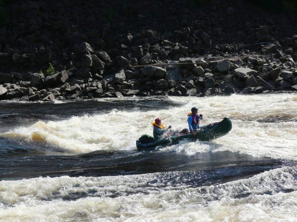
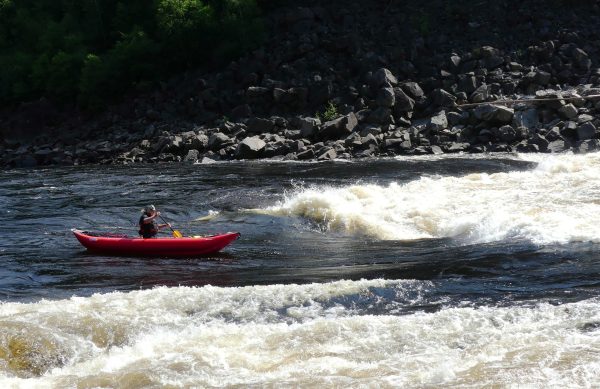
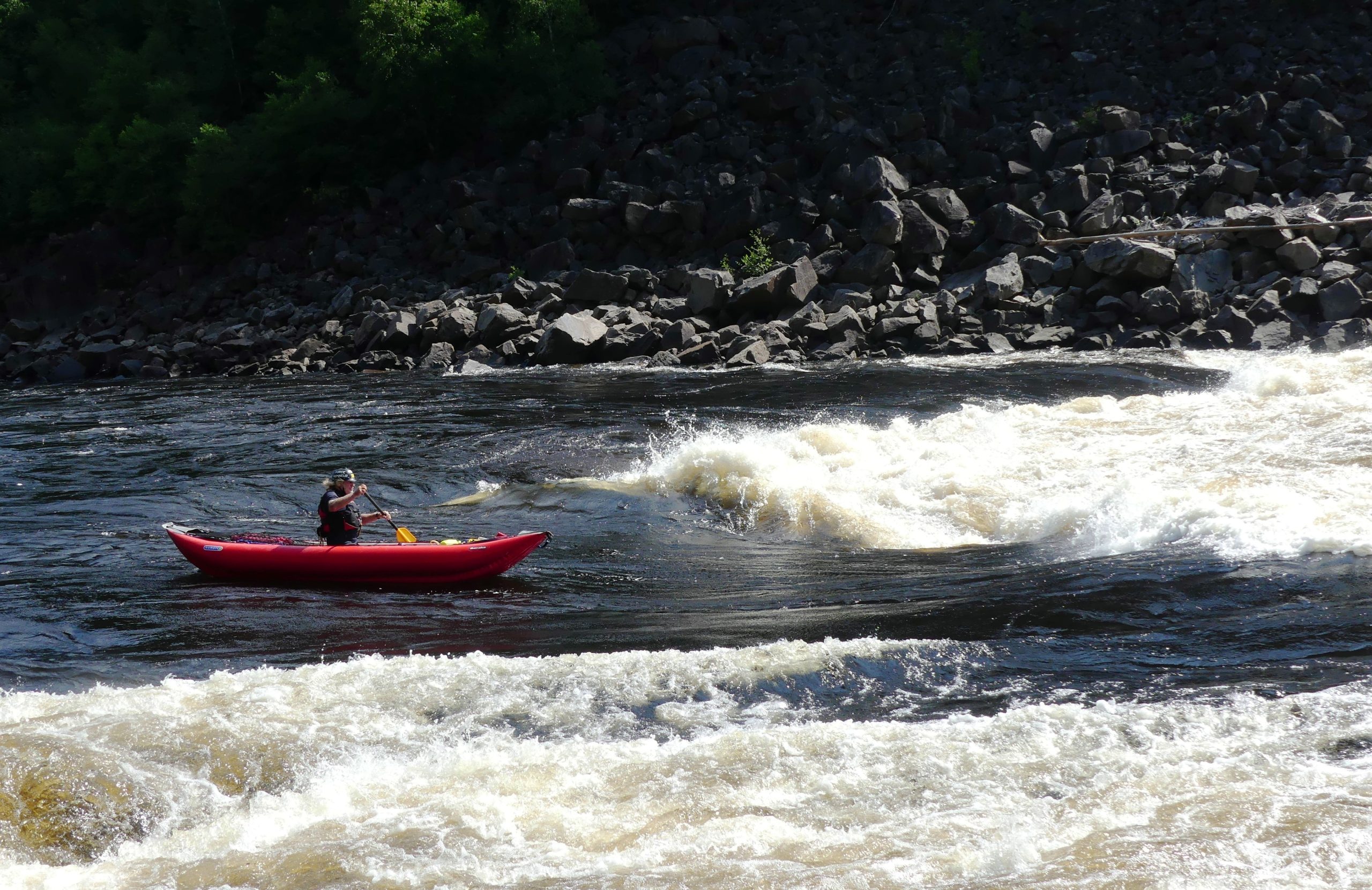
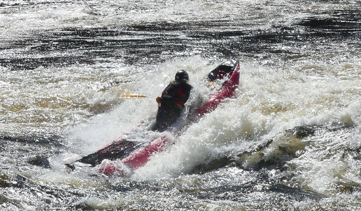
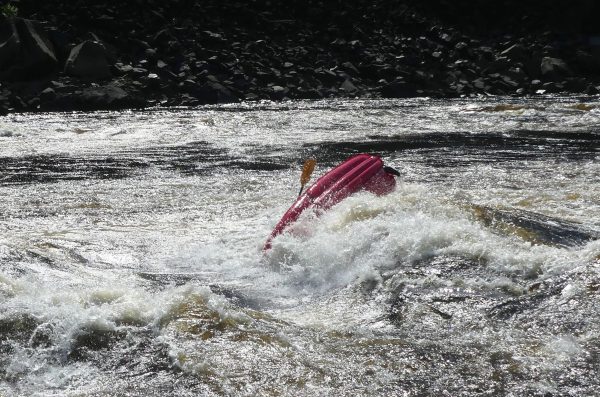
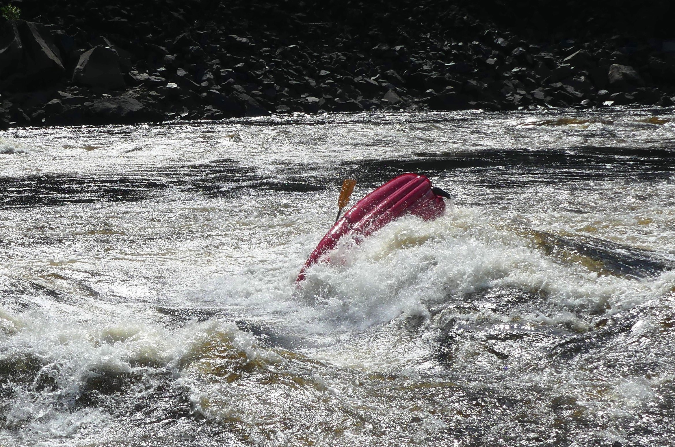
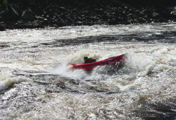
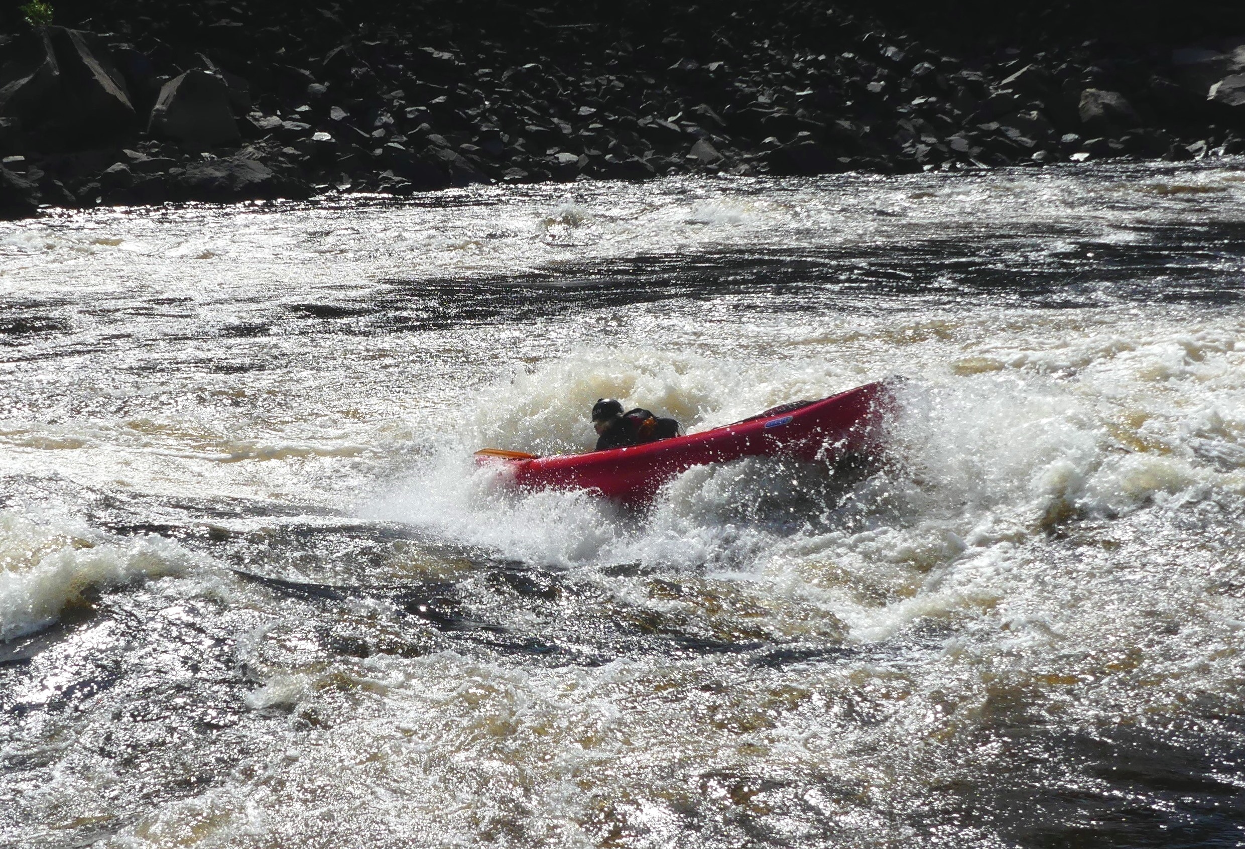
The great gorge of the Moisie, is actually out of the “Aquatic Reserve” perimeter but still a wild section, given that the railway is high above the left bank and invisible. It’s a delight to paddle thanks to its “Big-Water” feel (high-volume rapids), but without any real danger if you avoid the “R5” rapid at km 31. After this, we would encounter six superb rapids, all of them big-water, 40 to 80 m wide, with rolling waves and a few holes up to two-metre high. We must fight first with some really big boils right below the R5, than we enjoy a rodeo sessions in some rolling waves…
-
- Inflatable kayaks and canoes on the Moisie River
-
- Inflatable kayaks and canoes on the Moisie River
-
- Inflatable kayaks and canoes on the Moisie River
-

- Inflatable kayaks and canoes on the Moisie River
-
- Inflatable kayaks and canoes on the Moisie River
-
- Inflatable kayaks and canoes on the Moisie River
Finally we scout and run the four rapids R3 and two R4 one after the other, pass under the huge railway bridge, one last long wave train, one last R1 and… it’s the end of the gorge towards kilometre point 26.
-

- Inflatable kayaks and canoes on the Moisie River
-
- Inflatable kayaks and canoes on the Moisie River
-

- Inflatable kayaks and canoes on the Moisie River
At this point, the valley opens up and the first cabins make their appearance, more like spacious wooden houses now, heralding our definitive return to civilization! We paddle for another 14 km on the 200-300 m wide Moisie, before reaching the bridge of the only road of the “Côte-Nord” region, the end of our journey.
-
- Inflatable kayaks and canoes on the Moisie River

-

- Inflatable kayaks and canoes on the Moisie River
Author: Laurent Nicolet – August 17th 2024 – Photos Laurent Nicolet & Pierre Dabout
Other articles
Seawave and safety
Paddling back into a shelter, even when one (or two!) side-tubes are punctured!
Being able to paddle to a shelter, even when the floor of your Seawave is punctured!
Seawave overturned in the open sea – emptying, righting and climbing-in!
Gumotex and field testing: a win-win for everyone
Hi, I'm Matthes from Germany. For some time now, I've had the privilege of testing new Gumotex products before their official release.
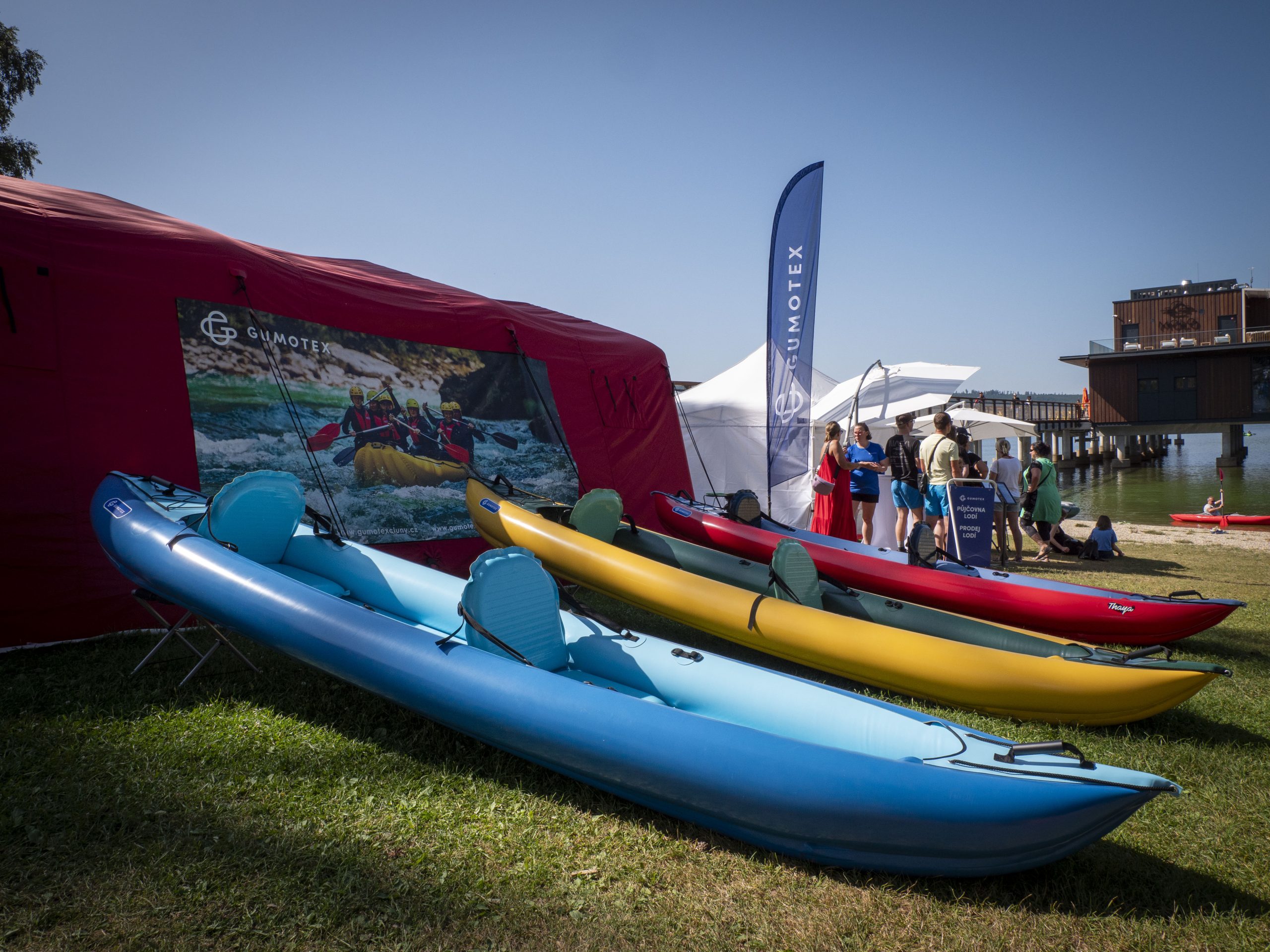
Lipno Sport Festival 2024
This year we were again (for the third time) among the providers of good mood and great experiences at the Lipno Sport Festival, which was visited by around 50,000 enthusiasts from all over the world.